world.wikisort.org - Royaume-Uni
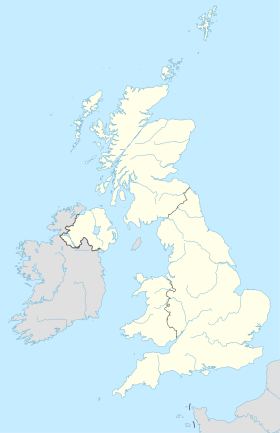
Waltham Abbey est une ville d'environ 20 000 habitants dans le sud-ouest du comté d'Essex, dans l'est de l'Angleterre. Elle est située à 24 km de Londres sur le méridien de Greenwich, entre la rivière Lea et Epping Forest.
Pour les articles homonymes, voir Waltham et Abbey.
Waltham Abbey tient son nom de l'église de Waltham Abbey, un monument classé qui domine la ville depuis le Moyen Âge. La ville est incluse dans la paroisse civile de l’abbaye de Waltham (en) qui portait le nom de Waltham Holy Cross jusque 1974.

Jumelage
 Hörstel (Allemagne)
- Portail de l’Angleterre
На других языках
[de] Waltham Abbey (Stadt)
Waltham Abbey ist eine vorstädtische Marktgemeinde und ein Civil Parish im Epping Forest District in Essex. Die Stadt liegt auf dem Meridian von Greenwich, zwischen dem Fluss Lea im Westen und Epping Forest im Osten. Sie ist 14 Meilen vom Zentrum Londons entfernt und liegt am Rande von Nordost-London, mit dem Metropolitan Green Belt im Norden, Osten und Süden der Stadt. Für statistische Zwecke wird Waltham Abbey in die Metropolregion London (Greater London Urban Area) einbezogen. Sie hatte 2019 über 22.000 Einwohner.[1][en] Waltham Abbey
Waltham Abbey is a town and civil parish in the Epping Forest District of Essex, within the metropolitan and urban area of London, England, 14 miles (23 km) north-east of Charing Cross. It lies on the Greenwich Meridian, between the River Lea in the west and Epping Forest in the east, with large sections forming part of the Metropolitan Green Belt. It borders Nazeing and Epping Upland to the north, Chingford to the south, Loughton, Theydon Bois and Buckhurst Hill to the east and south-east, and Waltham Cross, Cheshunt and Enfield to the west.- [fr] Waltham Abbey
Текст в блоке "Читать" взят с сайта "Википедия" и доступен по лицензии Creative Commons Attribution-ShareAlike; в отдельных случаях могут действовать дополнительные условия.
Другой контент может иметь иную лицензию. Перед использованием материалов сайта WikiSort.org внимательно изучите правила лицензирования конкретных элементов наполнения сайта.
Другой контент может иметь иную лицензию. Перед использованием материалов сайта WikiSort.org внимательно изучите правила лицензирования конкретных элементов наполнения сайта.
2019-2025
WikiSort.org - проект по пересортировке и дополнению контента Википедии
WikiSort.org - проект по пересортировке и дополнению контента Википедии


