world.wikisort.org - United_Kingdom
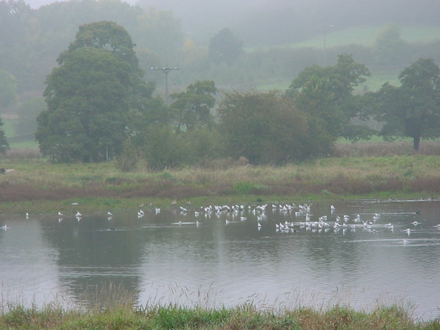
Wyver Lane Nature Reserve, also known as Wyver Lane Pool Reserve, lies west of the River Derwent just north of Belper. The reserve occupies a nineteen-acre site and is part of the Derwent Valley Heritage Way. It is also placed on reoccurring flood plain which makes it an attractive place for wildlife, especially wading birds.
This article does not cite any sources. (September 2013) |
| Wyver | |
|---|---|
 Wyver Lane Nature Reserve | |
 Wyver Location within Derbyshire | |
| OS grid reference | SK342499 |
| District | |
| Shire county | |
| Region | |
| Country | England |
| Sovereign state | United Kingdom |
| Post town | BELPER |
| Postcode district | DE56 |
| Police | Derbyshire |
| Fire | Derbyshire |
| Ambulance | East Midlands |
Derbyshire Wildlife Trust leases the area from Amber Valley Borough Council and now manages it as a nature reserve and is one of Derbyshire’s most important wetland reserves.
To ensure that the many bird species continue to thrive there, there is no access onto the reserve. The reserve consists of two pools surrounded by water meadows and reed beds. A large number of bird species has been recorded there over the years.
History
When Belper Mill was originally built in the 1700s, the mill company dammed the River Derwent to channel water to power the mill. To avoid overflow, the riverbank was raised north of the mill where the reserve now stands. However, the river breached many times forming several pools that can be seen today.
In later years, the Territorial Army used the area for shooting practice. The old firing range can still be seen at the bottom of the lane; several buttresses are still visible – one is the island on the left-hand side of the main pool, another is barely visible on the right-hand side of the main pool, and others have now almost disappeared. To the left of the viewing mound is an old metal gatepost that was used by the Territorials: if there was a green flag on the gate it was safe to go through. If a red flag, then it wasn't. A little further down the lane is a bricked-up hut on the left-hand side, the former ammunition store. Because the reservists did not want water on the land they used to pump it into the river. The pumphouse is the brick building at the southern end of the reserve with the protruding pipe.
After the army had finished using the land, Amber Valley Council started using it as a tip. The accumulated rubbish pushed water further up, creating bigger pools. A few local birders still sometimes pump out water into the river to keep the pools low to attract waders. As with most tips, it used to be good for gulls, including visits from Iceland and glaucous gulls. The tip closed in the 1970s. Levels are now controlled by a sluice at the southern end of the main pool. There is also a pipe from the main pool to the river which is bunged during winter to maintain the water levels for wintering wildfowl. In spring it is removed; if there is a dry summer it should be low enough to attract waders in late summer or autumn.
References
External links
- Wyver Lane - Derbyshire Wildlife Trust
Другой контент может иметь иную лицензию. Перед использованием материалов сайта WikiSort.org внимательно изучите правила лицензирования конкретных элементов наполнения сайта.
WikiSort.org - проект по пересортировке и дополнению контента Википедии