world.wikisort.org - United_Kingdom
Wood Farm is a residential district of Oxford, England, south of Headington in the southeast of the city. It largely consists of social housing built in the 1950s and 1960s, originally intended to house workers from the nearby car factory.[1] The Eastern By-Pass is to the east, Cowley is to the southwest and Headington Quarry is to the north.
| Wood Farm | |
|---|---|
 Forester Tower | |
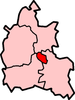
 Wood Farm Location within Oxfordshire | |
| OS grid reference | SP553059 |
| District |
|
| Shire county |
|
| Region |
|
| Country | England |
| Sovereign state | United Kingdom |
| Post town | Oxford |
| Postcode district | OX3 |
| Dialling code | 01865 |
| Police | Thames Valley |
| Fire | Oxfordshire |
| Ambulance | South Central |
| UK Parliament |
|
Services
Oxford City Council organizes street wardens in the area.[2] Wood Farm has a Community Centre in Titup Hall Drive.[3] Wood Farm has a primary school.[4]
The area also has regular bus services to Oxford city centre as well as Headington, Cowley, Botley, and Abingdon.
References
- "History of Headington, Oxford". www.headington.org.uk. Archived from the original on 24 November 2010.
- Oxford City Council: Street Wardens — Wood Farm area
- Touchlocal.com: Wood Farm Community Centre
- Wood Farm School
The City of Oxford | ||
|---|---|---|
| ||
| Wards, suburbs, neighbourhoods and districts |
|  |
| Civil parishes |
| |
| Former district and borough |
| |
| Former constituencies |
| |
| ||
This Oxfordshire location article is a stub. You can help Wikipedia by expanding it. |
Текст в блоке "Читать" взят с сайта "Википедия" и доступен по лицензии Creative Commons Attribution-ShareAlike; в отдельных случаях могут действовать дополнительные условия.
Другой контент может иметь иную лицензию. Перед использованием материалов сайта WikiSort.org внимательно изучите правила лицензирования конкретных элементов наполнения сайта.
Другой контент может иметь иную лицензию. Перед использованием материалов сайта WikiSort.org внимательно изучите правила лицензирования конкретных элементов наполнения сайта.
2019-2025
WikiSort.org - проект по пересортировке и дополнению контента Википедии
WikiSort.org - проект по пересортировке и дополнению контента Википедии