world.wikisort.org - United_Kingdom
West Drayton is a village and civil parish in the Bassetlaw district in the county of Nottinghamshire, England. It lies 24 miles (39 km) north east of Nottingham and 4 miles (6.4 km) south of Retford.
| West Drayton | |
|---|---|
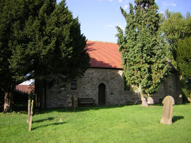 St Paul's Church | |
 West Drayton Location within Nottinghamshire | |
| Area | 3.849 km2 (1.486 sq mi) |
| Population | 225 (2011 census) |
| • Density | 58/km2 (150/sq mi) |
| OS grid reference | SK709746 |
| Civil parish |
|
| District |
|
| Shire county |
|
| Region |
|
| Country | England |
| Sovereign state | United Kingdom |
| Post town | Retford |
| Postcode district | DN22 |
| UK Parliament |
|
In 2011 the parish had a population of 225.[1] The parish includes the villages of Rockley and Markham Moor.
West Drayton was originally known simply as Drayton, and was recorded under that name in the Domesday Book of 1086.[2] "West" was added to distinguish the place from the village of East Drayton, 4 miles east.
St Paul's Church dates back to the 12th century, but was rebuilt in 1874. It is a Grade II* listed building.[3]
References
- UK Census (2011). "Local Area Report – West Drayton Parish (E04007850)". Nomis. Office for National Statistics. Retrieved 30 August 2020.
- "The Domesday Book Online". Retrieved 31 August 2020.
- Historic England. "Church of St Paul (1224416)". National Heritage List for England. Retrieved 30 August 2020.
External links
![]() Media related to West Drayton, Nottinghamshire at Wikimedia Commons
Media related to West Drayton, Nottinghamshire at Wikimedia Commons
Текст в блоке "Читать" взят с сайта "Википедия" и доступен по лицензии Creative Commons Attribution-ShareAlike; в отдельных случаях могут действовать дополнительные условия.
Другой контент может иметь иную лицензию. Перед использованием материалов сайта WikiSort.org внимательно изучите правила лицензирования конкретных элементов наполнения сайта.
Другой контент может иметь иную лицензию. Перед использованием материалов сайта WikiSort.org внимательно изучите правила лицензирования конкретных элементов наполнения сайта.
2019-2025
WikiSort.org - проект по пересортировке и дополнению контента Википедии
WikiSort.org - проект по пересортировке и дополнению контента Википедии