world.wikisort.org - United_Kingdom
Upper Camster is a small hamlet, which lies at the source of the Camster Burn, 4 miles north of Lybster, in Caithness, Scottish Highlands and is in the Scottish council area of Highland.[1]
| Upper Camster | |
|---|---|
 Upper Camster Location within the Caithness area | |
| OS grid reference | ND262414 |
| Council area |
|
| Country | Scotland |
| Sovereign state | United Kingdom |
| Postcode district | KW3 6 |
| Police | Scotland |
| Fire | Scottish |
| Ambulance | Scottish |
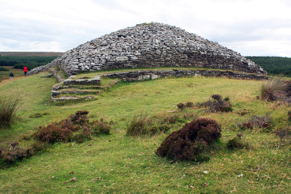
The Grey Cairns of Camster are two large Neolithic chambered cairns located about quarter of a mile north of Upper Camster. The cairns, which are considered to be examples of the Orkney-Cromarty type of chambered cairn, were constructed in the third or fourth millennium BC in a desolate stretch of boggy peat-covered moorland in the Flow Country of Caithness.[2]
Gallery
 Camster Long Cairn, Upper Camster
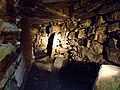 Burial chamber inside Camster Long.
 Camster Cairns.
 The Grey Cairns of Camster. These cairns are open to the public.
 Grey Cairns of Camster, Caithness, Scotland - Camster Long Cairn, exterior
 Remote road the in the flow country


References
- Microsoft; Nokia (4 January 2018). "Upper Camster" (Map). Bing Maps. Microsoft. Retrieved 4 January 2018.
- "Grey Cairns of Camster". Historic Environment Scotland. Retrieved 4 January 2018.
This Highland location article is a stub. You can help Wikipedia by expanding it. |
Текст в блоке "Читать" взят с сайта "Википедия" и доступен по лицензии Creative Commons Attribution-ShareAlike; в отдельных случаях могут действовать дополнительные условия.
Другой контент может иметь иную лицензию. Перед использованием материалов сайта WikiSort.org внимательно изучите правила лицензирования конкретных элементов наполнения сайта.
Другой контент может иметь иную лицензию. Перед использованием материалов сайта WikiSort.org внимательно изучите правила лицензирования конкретных элементов наполнения сайта.
2019-2026
WikiSort.org - проект по пересортировке и дополнению контента Википедии
WikiSort.org - проект по пересортировке и дополнению контента Википедии