world.wikisort.org - United_Kingdom
Upottery (originally Up Ottery) is a rural village, civil parish and former manor in East Devon, England.
| Upottery | |
|---|---|
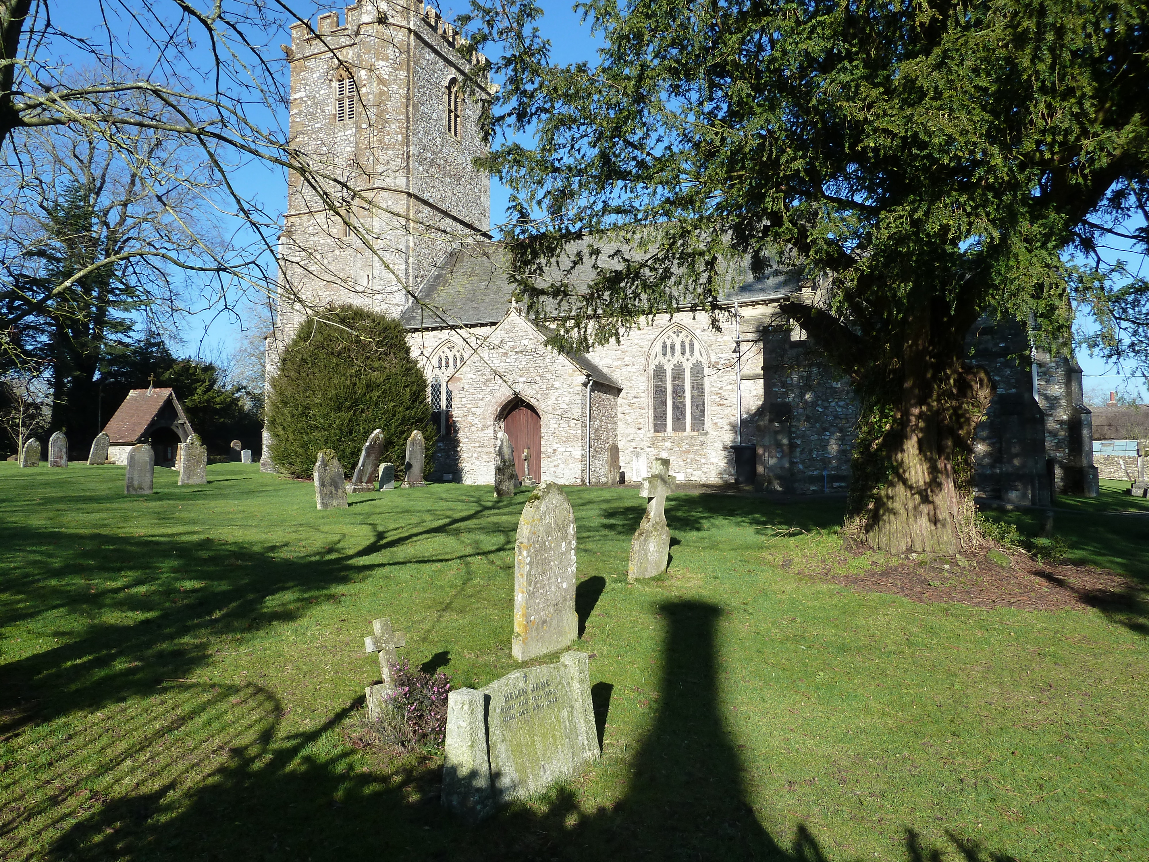 Upottery church | |
 Upottery Location within Devon | |
| Area | 23.89 km2 (9.22 sq mi) |
| Population | 701 (2011 census)[1] |
| • Density | 29/km2 (75/sq mi) |
| District |
|
| Shire county |
|
| Region | |
| Country | England |
| Sovereign state | United Kingdom |
| Post town | Honiton |
| Postcode district | EX14 |
| Dialling code | 01404 |
| Police | Devon and Cornwall |
| Fire | Devon and Somerset |
| Ambulance | South Western |
| UK Parliament |
|
Location
Upottery takes up both sides of the upper vale of the Otter which flows to the English Channel south of Ottery St Mary and is a clustered village.
Its northern limit forms the border with Somerset. Clockwise from which are the Devon parishes of Yarcombe, Stockland, Cotleigh, Monkton, Luppitt and Clayhidon.[2]
History
Parts of the parish church of St Mary the Virgin date from the 12th century.[3] The Viscounts Portman, as in Portman Square and surrounding areas of London, which remain the family hands, held the manor house and main lands here for about two centuries but in 1934 inherited a property in Wiltshire which they substituted for this home, casting off local landholding also to other ownership, on sale.
The former World War II airfield of RAF Upottery is in the outer parts of the parish.
Housing and demography
| Type | Number | Percentage |
|---|---|---|
| Whole house or bungalow: Detached | 227 | 73.9% |
| Whole house or bungalow: Semi-detached | 51 | 16.6% |
| Whole house or bungalow: Terraced (including end-terrace) | 18 | 5.9% |
| Flat, maisonette or apartment | 9 | 3.1% |
Most, 81.6%, of housing is owned (with/without mortgage); the next largest category is 12.0% which is privately rented, next is socially rented which is 3.9% of the stock as residents identified in 2011.[1] 7.8% of the 307 homes had (in 2011) no usual residents.[1]
The United Kingdom Census 2011 recorded the population of the parish as 701.
In media, literature and the arts
Fields and some houses featured in the 2001 television mini-series Band of Brothers.
References
- "Custom report - Nomis - Official Labour Market Statistics".
- "Map of Devon Parishes" (PDF). Devon County Council. Retrieved 7 July 2016.
- "St Mary the Virgin Church, Upottery". Dunkeswell Mission Community. Retrieved 1 December 2014.
External links
- upottery.com, website supported by Upottery Parish Council
![]() Media related to Upottery at Wikimedia Commons
Media related to Upottery at Wikimedia Commons
Authority control | |
|---|---|
| General |
|
| National libraries | |
На других языках
[de] Upottery
Upottery (Über dem Otter) ist ein zur englischen Grafschaft Devon gehörende und etwa 44 Kilometer nordöstlich der Stadt Exeter gelegenes Dorf und Civil parish. 2011 wohnten im Parish 701 Einwohner.[1]- [en] Upottery
Другой контент может иметь иную лицензию. Перед использованием материалов сайта WikiSort.org внимательно изучите правила лицензирования конкретных элементов наполнения сайта.
WikiSort.org - проект по пересортировке и дополнению контента Википедии