world.wikisort.org - United_Kingdom
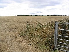
Togston is a settlement and civil parish about 10 miles from Morpeth, in the county of Northumberland, England. The parish includes the hamlet of North Togston. In 2011 the parish had a population of 315.[1] The parish borders Acklington, Amble By the Sea, East Chevington and Hauxley.[2]
| Togston | |
|---|---|
 | |
 Togston Location within Northumberland | |
| Area | 4.346 km2 (1.678 sq mi) |
| Population | 315 (2011 census) |
| • Density | 72/km2 (190/sq mi) |
| Civil parish |
|
| Unitary authority | |
| Shire county | |
| Region |
|
| Country | England |
| Sovereign state | United Kingdom |
| Website | https://northumberlandparishes.uk/togston |
Features
There are 7 listed buildings in Togston.[3]
History
The name "Togston" means 'Tocg's valley'.[4] Togston was formerly a township in the parish of Warkworth,[5] in 1866 Togston became a civil parish in its own right.[6]
References
- "Togston". City Population De. Retrieved 13 November 2021.
- "Togston". Ordnance Survey. Retrieved 13 November 2021.
- "Listed buildings in Togston, Northumberland". British Listed Buildings. Retrieved 13 November 2021.
- "Togston Key to English Place-names". The University of Nottingham. Retrieved 13 November 2021.
- "History of Togston, in Alnwick and Northumberland". A Vision of Britain through Time. Retrieved 13 November 2021.
- "Relationships and changes Togston Tn/CP through time". A Vision of Britain through Time. Retrieved 13 November 2021.
External links
- Parish council
- "Togston". Keys to the Past. Retrieved 13 November 2021.
Wikimedia Commons has media related to Togston.
Текст в блоке "Читать" взят с сайта "Википедия" и доступен по лицензии Creative Commons Attribution-ShareAlike; в отдельных случаях могут действовать дополнительные условия.
Другой контент может иметь иную лицензию. Перед использованием материалов сайта WikiSort.org внимательно изучите правила лицензирования конкретных элементов наполнения сайта.
Другой контент может иметь иную лицензию. Перед использованием материалов сайта WikiSort.org внимательно изучите правила лицензирования конкретных элементов наполнения сайта.
2019-2025
WikiSort.org - проект по пересортировке и дополнению контента Википедии
WikiSort.org - проект по пересортировке и дополнению контента Википедии