world.wikisort.org - United_Kingdom
Thorney is a village and civil parish about 2 and a half miles south west of Saxilby railway station,[1] in the Newark and Sherwood district, in the county of Nottinghamshire, England. In 2011, the parish had a population of 248.[2] The parish touches Wigsley, Kettlethorpe, Newton on Trent, Saxilby with Ingleby, Harby, North Clifton, South Clifton and Hardwick.[3]
| Thorney | |
|---|---|
 view from the lane to Westwood Farm | |
 Thorney Location within Nottinghamshire | |
| Area | 9.1021 km2 (3.5143 sq mi) |
| Population | 248 (2011 census) |
| • Density | 27/km2 (70/sq mi) |
| Civil parish |
|
| District |
|
| Shire county |
|
| Region |
|
| Country | England |
| Sovereign state | United Kingdom |
| Post town | NEWARK |
| Postcode district | NG23 |
| Police | Nottinghamshire |
| Fire | Nottinghamshire |
| Ambulance | East Midlands |
| UK Parliament |
|
| Website | https://www.nottinghamshire.gov.uk/council-and-democracy/local/parish-councils/thorney-parish-council |
Features
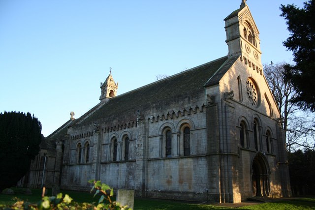
There are 6 listed buildings in Thorney.[4]
History
The name "Thorney" means 'Enclosure of thorn-trees'.[5] Thorney was recorded in the Domesday Book as Torneshaie.[6] Thorney parish also included the townships of Broadholme and Wigsley[7] which became separate parishes in 1866.[8][9] Iron Age, Bronze age and Roman settlements have been found. There was a Saxon settlement in around 500 AD. In 1853 the manor belonged to Rev. Christopher Nevile but was previously owned by the Nevile family. The parish was part of the Newark wapentake.[10]
References
- "History of Thorney, in Newark and Sherwood and Nottinghamshire". A Vision of Britain through Time. Retrieved 10 March 2019.
- UK Census (2011). "Local Area Report – Thorney Parish (E04007949)". Nomis. Office for National Statistics. Retrieved 10 March 2019.
- "Thorney". Ordnance Survey. Retrieved 10 March 2019.
- "Listed Buildings in Thorney, Newark and Sherwood, Nottinghamshire". British Listed Buildings. Retrieved 10 March 2019.
- "Thorney Key to English Place-names". The University of Nottingham. Retrieved 10 March 2019.
- "Nottinghamshire S-Z". The Domesday Book Online. Retrieved 10 March 2019.
- "Thorney". GENUKI. Retrieved 10 March 2019.
- "Relationships and changes Broadholme Hmlt/CP through time". A Vision of Britain through Time. Retrieved 10 March 2019.
- "Relationships and changes Wigsley CP/Hmlt through time". A Vision of Britain through Time. Retrieved 10 March 2019.
- "Thorney". GENUKI. Retrieved 15 March 2019.
External links
- "Parishes: Thorney". British History Online. Retrieved 15 March 2019.
Другой контент может иметь иную лицензию. Перед использованием материалов сайта WikiSort.org внимательно изучите правила лицензирования конкретных элементов наполнения сайта.
WikiSort.org - проект по пересортировке и дополнению контента Википедии