world.wikisort.org - United_Kingdom
For people with the surname, see Sancton (surname).
| Sancton | |
|---|---|
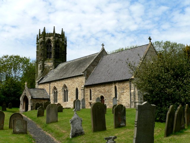 All Saints' Church, Sancton | |
 Sancton Location within the East Riding of Yorkshire | |
| Population | 286 (2011 census)[1] |
| OS grid reference | SE901392 |
| Civil parish |
|
| Unitary authority |
|
| Ceremonial county |
|
| Region |
|
| Country | England |
| Sovereign state | United Kingdom |
| Post town | YORK |
| Postcode district | YO43 |
| Dialling code | 01430 |
| Police | Humberside |
| Fire | Humberside |
| Ambulance | Yorkshire |
| UK Parliament |
|
Sancton is a village and civil parish in the East Riding of Yorkshire, England. It is situated approximately 2 miles (3.2 km) south-east of the market town of Market Weighton on the A1034 road.

The civil parish is formed by the village of Sancton and the hamlet of Houghton. According to the 2011 UK census, Sancton parish had a population of 286,[1] a reduction of one on the 2001 UK census figure.[2]
The church dedicated to All Saints was designated a Grade II* listed building in 1967 and is now recorded in the National Heritage List for England, maintained by Historic England.[3]
Sancton found that a horse's 'cart/carriage' was found in one of the surrounding fields. To be seen in London's History museum.
Places of interest
For places of interest in Sancton, see Market Weighton and North Newbald.
References
- UK Census (2011). "Local Area Report – Sancton Parish (1170211251)". Nomis. Office for National Statistics. Retrieved 24 February 2018.
- "2001 Census: Key Statistics: Parish Headcounts: Area: Sancton CP (Parish)". Neighbourhood Statistics. Office for National Statistics. Retrieved 20 May 2008.
- Historic England. "Church of All Saints (1084105)". National Heritage List for England. Retrieved 16 August 2013.
- Gazetteer — A–Z of Towns Villages and Hamlets. East Riding of Yorkshire Council. 2006. p. 10.
External links
- Sancton in the Domesday Book
This East Riding of Yorkshire location article is a stub. You can help Wikipedia by expanding it. |
Другой контент может иметь иную лицензию. Перед использованием материалов сайта WikiSort.org внимательно изучите правила лицензирования конкретных элементов наполнения сайта.
WikiSort.org - проект по пересортировке и дополнению контента Википедии