world.wikisort.org - United_Kingdom
Pailton is a village and civil parish in the Borough of Rugby, Warwickshire, England. Its population in 2001 was recorded as 482,[1] increasing at the 2011 Census to 516.[2] The village was originally known as Pailington.[3] Pailton is located approximately five miles northwest of Rugby and about five miles southwest of Lutterworth. It lies at a crossroads of three roads, one towards Rugby to the south, one towards Lutterworth to the east, and Nuneaton and Coventry towards the west.
| Pailton | |
|---|---|
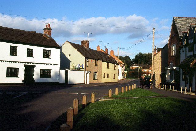 Pailton village centre | |
 Pailton Location within Warwickshire | |
| Population | 516 (2011) |
| OS grid reference | SP4781 |
| Civil parish |
|
| District |
|
| Shire county |
|
| Region |
|
| Country | England |
| Sovereign state | United Kingdom |
| Post town | RUGBY |
| Postcode district | CV23 |
| Dialling code | 01788 |
| Police | Warwickshire |
| Fire | Warwickshire |
| Ambulance | West Midlands |
| UK Parliament |
|
The former White Lion pub which ceased trading early in 2014 is one of the largest buildings in the village,[4] through much of the twentieth century there were three pubs in the village (The White Lion, The Plough, both former coaching inns, and The Fox). At the crossroads is the village green with a recently restored war memorial. About one mile east of Pailton is a radio station operated by the United Kingdom's National Air Traffic Services and is used for measurement and calibration purposes. The village church of St. Denys is built of red brick and dates from 1884.[3]
References
- ONS Neighbourhood Statistics Archived 2012-04-20 at the Wayback Machine
- "Civil Parish population 2011". Retrieved 31 December 2015.
- Geoff, Allen (2000). Warwickshire Towns & Villages. Sigma Press. p. 102. ISBN 1-85058-642-X.
- Souza, Naomi de (14 September 2019). "This much loved Warwickshire pub could open its doors again". coventrytelegraph.
External links
| Wikimedia Commons has media related to Pailton. |
This Warwickshire location article is a stub. You can help Wikipedia by expanding it. |
Другой контент может иметь иную лицензию. Перед использованием материалов сайта WikiSort.org внимательно изучите правила лицензирования конкретных элементов наполнения сайта.
WikiSort.org - проект по пересортировке и дополнению контента Википедии