world.wikisort.org - United_Kingdom
Newton Tony (formerly Newton Toney) is a rural English village and civil parish in the county of Wiltshire, close to the border with Hampshire. Situated in the Bourne Valley, Newton Tony is about 9 miles (14 km) north-east of its post town, Salisbury. It is the site of Wilbury House, a 17th-century mansion designed by William Benson.
| Newton Tony | |
|---|---|
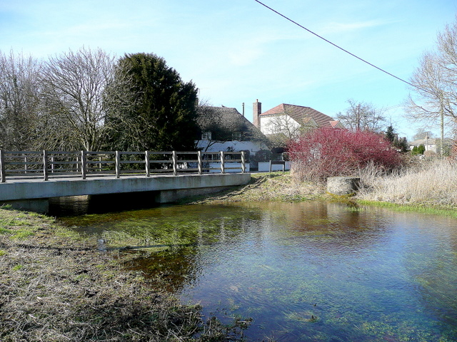 River Bourne at Newton Tony | |
 Newton Tony Location within Wiltshire | |
| Population | 381 (2011 Census)[1] |
| OS grid reference | SU216404 |
| Civil parish |
|
| Unitary authority |
|
| Ceremonial county | |
| Region | |
| Country | England |
| Sovereign state | United Kingdom |
| Post town | SALISBURY |
| Postcode district | SP4 |
| Dialling code | 01980 |
| Police | Wiltshire |
| Fire | Dorset and Wiltshire |
| Ambulance | South Western |
| UK Parliament |
|
| Website | Parish Council |
History
The Port Way Roman road crossed the parish to the south-east.[2] Newton Tony was recorded in the Domesday Book of 1086 as Newentone[3] and the settlement assessed as having an area of seven carucates (ploughlands) of land.[2] It was held by Alfred of Marlborough. A church had been built by the 12th century.[2]
The village was the birthplace of the pioneering travel writer Celia Fiennes (1662–1741).[4] A Wesleyan Methodist chapel was built in 1877 and closed in 1981.[5]
Until the late 20th century the name of the village and parish was Newton Toney.[6]
Governance
Like most of Wiltshire, Newton Tony is governed locally by Wiltshire Council, a unitary authority. The parish forms part of the ward of Bulford, Allington and Figheldean. In the 2013 election, as in 2009, the ward elected one councillor: the Conservative John Smale.[7]
Newton Tony is represented in the House of Commons as part of the constituency of Salisbury. Since the 2010 general election, Salisbury has been represented in Parliament by the Conservative MP John Glen.[8]
Geography
Newton Tony is approximately 9 miles (14 km) north-east of its post town, Salisbury, about 30 miles (48 km) north-west of Southampton and about 40 miles (64 km) south-east of Bath. Nearby towns and villages include Cholderton, Allington, Amesbury and Grateley.
Newton Tony lies in the valley of the River Bourne, which cuts through the village.[2]
Notable buildings
Wilbury House is an 18th-century house designed by William Benson. It has been designated a Grade I listed building.[9] A combined summer house and ice house in the grounds, from the same date, is designated Grade II*.[10]
The parish church of St Andrew was built in 1844 to a design by Thomas Henry Wyatt and David Brandon. It is a flint church with a steeple and is Grade II listed.[11] The former rectory was built for Reverend John Akins in 1778, in Flemish brick on a stone plinth.[12] A redbrick Wesleyan Methodist chapel was built in the High Street in 1877; it closed in 1981.[13]
Railways
In 1857 the London and South Western Railway company opened a line from Andover to Milford station at Salisbury, which crosses the parish south-east of Newton Tony village, parallel to the Port Way. The railway remains in use as part of the West of England Main Line; the nearest station is Grateley, some 3 miles (5 km) east of Newton Tony village.
The Amesbury and Military Camp Light Railway, opened in 1902, connected with the main line to the east of the village. It carried largely military goods and passengers to Amesbury, extending later to Bulford, Larkhill and Rollestone. There was a station with two platforms, a goods siding and cattle yard west of Newton Tony, to the south of the Allington road.[14] The line closed to passengers in 1952 and to goods in 1963, after which the track was dismantled.
Amenities
Newton Tony C of E Primary School serves the village and neighbouring communities. It was opened in the 1950s on the same site as a national school built in 1857, which was destroyed by fire. Land for the school had been given by Sir Alexander Malet.[15]
The village has a recreation ground and a village hall. The village pub, the Malet Arms, is in a building from the early 18th century.[16]
References
- "Newton Tony: Population". Wiltshire Community History. Wiltshire Council. Retrieved 4 October 2022.
- "Victoria County History – Wiltshire – Vol 15 pp143-153 – Parishes: Newton Tony". British History Online. University of London. Retrieved 8 January 2016.
- "Newton Tony, Wiltshire – 70r Great Domesday Book", DocumentsOnline, The National Archives, retrieved 16 August 2011
- "June 7th 1662. Birth of Celia Fiennes". History Today LXII/6, June 2012, p. 9.
- "Wesleyan Methodist Chapel, Newton Tony". Wiltshire Community History. Wiltshire Council. Retrieved 8 January 2016.
- "Ordnance Survey 1:25,000 maps of Great Britain, sheet SU24". National Library of Scotland. 1958. Retrieved 7 January 2015.
- Election Candidate Details, Wiltshire Council, 12 April 2010, retrieved 16 August 2011
- "John Glen", UK Parliament website, Parliament of the United Kingdom, retrieved 7 January 2016
- Historic England. "Wilbury House (1300348)". National Heritage List for England. Retrieved 7 January 2016.
- Historic England. "Summer House at Wilbury House (1313163)". National Heritage List for England. Retrieved 7 January 2016.
- Historic England. "Church of St Andrew (1135699)". National Heritage List for England. Retrieved 7 January 2016.
- Historic England. "Old Rectory (1184164)". National Heritage List for England. Retrieved 30 April 2019.
- "Wesleyan Methodist Chapel, Newton Tony". Wiltshire Community History. Wiltshire Council. Retrieved 14 November 2021.
- Oakley, Mike (2004). Wiltshire Railway Stations. Wimborne: The Dovecote Press. p. 95. ISBN 1904349331.
- "Newton Tony Church of England VC Primary School". Wiltshire Community History. Wiltshire Council. Retrieved 8 January 2016.
- Historic England. "Malet Arms (1184127)". National Heritage List for England. Retrieved 8 January 2016.
External links
![]() Media related to Newton Tony at Wikimedia Commons
Media related to Newton Tony at Wikimedia Commons
Другой контент может иметь иную лицензию. Перед использованием материалов сайта WikiSort.org внимательно изучите правила лицензирования конкретных элементов наполнения сайта.
WikiSort.org - проект по пересортировке и дополнению контента Википедии