world.wikisort.org - United_Kingdom
Kincardine (Scottish Gaelic: Cinn Chàrdainn) is a small hamlet in Sutherland, situated on the west end of the south shore of the Dornoch Firth.[1] The village of Ardgay is less than 1 mile north west of Kincardine along the A836 coast road.
Kincardine
| |
|---|---|
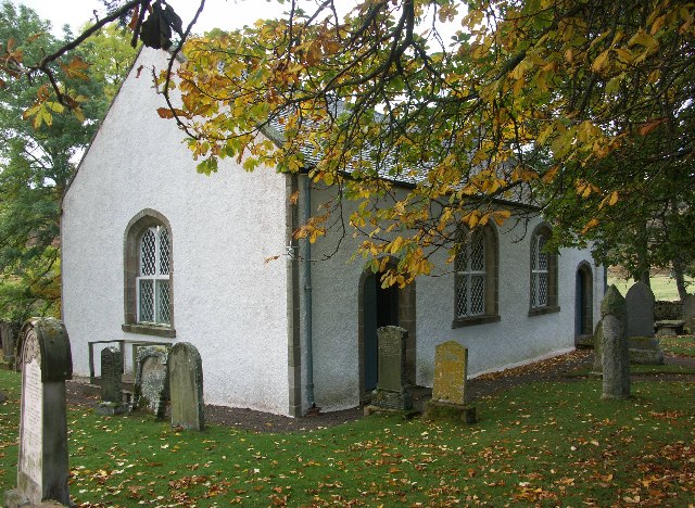 Croick Old Parish Church. Croick Church was built, with Government Grants, in 1827 at a cost of £1527 to plans by Thomas Telford. Glencalvie was cleared in 1845 and the names of many of the people evicted can be seen scratched in the windows of the church. | |
 Kincardine Location within the Sutherland area | |
| OS grid reference | NH607894 |
| Council area |
|
| Lieutenancy area |
|
| Country | Scotland |
| Sovereign state | United Kingdom |
| Post town | Ardgay |
| Postcode district | IV24 3 |
| Dialling code | 01863 766xxx |
| Police | Scotland |
| Fire | Scottish |
| Ambulance | Scottish |
| UK Parliament |
|
Etymology
The name Kincardine, as with other locations so-named, may be a Gaelic adaptation of a Pictish name.[2] The second element is the Pictish *carden, perhaps meaning "encampment" or "brake".[2] The first element represent Gaelic ceann substituting an original Pictish *pen, both meaning "end, head, top",[2] giving an aboriginal form of *Pencarden.[2]
See also
- Kincardine (disambiguation)
References
- Gittings, Bruce; Munro, David. "Kincardine". The Gazetteer for Scotland. School of GeoSciences, University of Edinburgh and The Royal Scottish Geographical Society. Retrieved 29 October 2018.
- Hall, Mark A; Driscoll, Stephen T; Geddess, Jane (11 November 2010). Pictish Progress: New Studies on Northern Britain in the Early Middle Ages. Brill. p. 85. ISBN 9789004188013. Retrieved 30 June 2019.
This Scottish location article is a stub. You can help Wikipedia by expanding it. |
Текст в блоке "Читать" взят с сайта "Википедия" и доступен по лицензии Creative Commons Attribution-ShareAlike; в отдельных случаях могут действовать дополнительные условия.
Другой контент может иметь иную лицензию. Перед использованием материалов сайта WikiSort.org внимательно изучите правила лицензирования конкретных элементов наполнения сайта.
Другой контент может иметь иную лицензию. Перед использованием материалов сайта WikiSort.org внимательно изучите правила лицензирования конкретных элементов наполнения сайта.
2019-2025
WikiSort.org - проект по пересортировке и дополнению контента Википедии
WikiSort.org - проект по пересортировке и дополнению контента Википедии