world.wikisort.org - United_Kingdom
Kilnwick Percy is a hamlet in the East Riding of Yorkshire, England. It is situated approximately 1.5 miles (2.4 km) north-east of Pocklington town centre, and to the north of the B1246 road.
| Kilnwick Percy | |
|---|---|
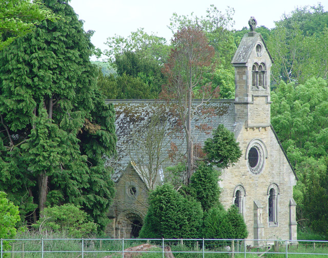 St Helen’s Church, Kilnwick Percy | |
 Kilnwick Percy Location within the East Riding of Yorkshire | |
| OS grid reference | SE825500 |
| • London | 170 mi (270 km) S |
| Civil parish |
|
| Unitary authority |
|
| Ceremonial county |
|
| Region |
|
| Country | England |
| Sovereign state | United Kingdom |
| Post town | YORK |
| Postcode district | YO42 |
| Dialling code | 01759 |
| Police | Humberside |
| Fire | Humberside |
| Ambulance | Yorkshire |
| UK Parliament |
|
Kilnwick Percy forms part of the civil parish of Nunburnholme.
Kilnwick Percy Hall is a Grade II* listed country house built around 1845.[1] It is now a Buddhist meditation and retreat centre.[2]

The grounds of the hall include a lake and a small church in the Norman style dedicated to Saint Helen. The church is designated a Grade II listed building and is now recorded in the National Heritage List for England, maintained by Historic England.[3]
In 1823 Kilnwick Percy was a civil parish in the Wapentake and Liberty of Holderness. The ecclesiastical parish was under the patronage of the Dean of York. Population at the time was 43.[4]
References
- Historic England. "Kilnwick Percy Hall (1309858)". National Heritage List for England. Retrieved 6 February 2013.
- "Welcome to Madhyamaka Buddhist Centre". Madhyamaka Buddhist Meditation Centre. Retrieved 19 May 2009.
- Historic England. "Church of St Helen (1346280)". National Heritage List for England. Retrieved 29 April 2013.
- Baines, Edward (1823). History, Directory and Gazetteer of the County of York. p. 360.
- Gazetteer — A–Z of Towns Villages and Hamlets. East Riding of Yorkshire Council. 2006. p. 7.
External links
 Media related to Kilnwick Percy at Wikimedia Commons
- Kilnwick Percy in the Domesday Book
This East Riding of Yorkshire location article is a stub. You can help Wikipedia by expanding it. |
Другой контент может иметь иную лицензию. Перед использованием материалов сайта WikiSort.org внимательно изучите правила лицензирования конкретных элементов наполнения сайта.
WikiSort.org - проект по пересортировке и дополнению контента Википедии