world.wikisort.org - United_Kingdom
Inverdruie (Scottish Gaelic: Inbhir Dhrùidh) is a small rural hamlet, that lies 2 miles southeast of Aviemore, in the strath of the River Spey, in the west Cairngorms National Park, in Badenoch and Strathspey, Inverness-shire, Scottish Highlands and is in the Scottish council area of Highland.[1]
Inverdruie
| |
|---|---|
 | |
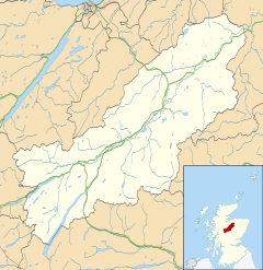 Inverdruie Location within the Badenoch and Strathspey area | |
| OS grid reference | NH902108 |
| Council area |
|
| Country | Scotland |
| Sovereign state | United Kingdom |
| Post town | Aviemore |
| Postcode district | PH22 1 |
| Police | Scotland |
| Fire | Scottish |
| Ambulance | Scottish |
The single track B970 B road which connects Kingussie to Aviemore passes Inverdruie.
Gallery


References
- Gittings, Bruce; Munro, David. "Inverdruie". The Gazetteer for Scotland. School of GeoSciences, University of Edinburgh and The Royal Scottish Geographical Society. Retrieved 30 July 2018.
Текст в блоке "Читать" взят с сайта "Википедия" и доступен по лицензии Creative Commons Attribution-ShareAlike; в отдельных случаях могут действовать дополнительные условия.
Другой контент может иметь иную лицензию. Перед использованием материалов сайта WikiSort.org внимательно изучите правила лицензирования конкретных элементов наполнения сайта.
Другой контент может иметь иную лицензию. Перед использованием материалов сайта WikiSort.org внимательно изучите правила лицензирования конкретных элементов наполнения сайта.
2019-2025
WikiSort.org - проект по пересортировке и дополнению контента Википедии
WikiSort.org - проект по пересортировке и дополнению контента Википедии