world.wikisort.org - United_Kingdom
Hilston is a village in the East Riding of Yorkshire, England, near the North Sea coast in an area known as Holderness. It is situated approximately 12 miles (19 km) east of Kingston upon Hull city centre and 5 miles (8 km) north-west of Withernsea. It lies to the east of the B1242 road.
| Hilston | |
|---|---|
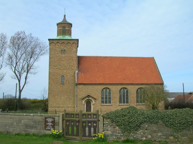 St Margaret's Church, Hilston | |
 Hilston Location within the East Riding of Yorkshire | |
| OS grid reference | TA288336 |
| • London | 155 mi (249 km) S |
| Civil parish | |
| Unitary authority |
|
| Ceremonial county |
|
| Region |
|
| Country | England |
| Sovereign state | United Kingdom |
| Post town | HULL |
| Postcode district | HU11 |
| Dialling code | 01964 |
| Police | Humberside |
| Fire | Humberside |
| Ambulance | Yorkshire |
| UK Parliament | |
Governance
Hilston forms part of the civil parish of Roos and is represented locally by Roos Parish Council[1] while at county level is in the South East Holderness ward of the East Riding of Yorkshire Council.[2] At a parliamentary level it is part of the Beverley and Holderness constituency which is represented by Graham Stuart of the Conservative Party.
Landmarks

An octagonal tower, known as Admiral Storr's Tower, that was built in 1750 as a folly for John Storr and is designated a Grade II listed building and recorded in the National Heritage List for England, maintained by Historic England.[3]
The Anglican church is dedicated to St Margaret[4] and was built 1956–57 to designs by Francis Johnson to replace the church destroyed by a Second World War bomb in August 1941.[5]
References
- "Parish Description". Roos Parish Council. Retrieved 27 March 2014.
- Gazetteer — A–Z of Towns Villages and Hamlets. East Riding of Yorkshire Council. 2006. p. 6.
- Historic England. "Admiral Storr's Tower (Hilston Mount) (1083508)". National Heritage List for England. Retrieved 30 April 2013.
- "Hilston: St Margaret, Hilston". A Church Near You. Church of England. Retrieved 27 March 2014.
- Pevsner, N.; Neave, D. (1995). Yorkshire: York and the East Riding. Buildings of England. Yale University Press. p. 472. ISBN 9780300095937.
External links
![]() Media related to Hilston at Wikimedia Commons
Media related to Hilston at Wikimedia Commons
- Hilston in the Domesday Book
Другой контент может иметь иную лицензию. Перед использованием материалов сайта WikiSort.org внимательно изучите правила лицензирования конкретных элементов наполнения сайта.
WikiSort.org - проект по пересортировке и дополнению контента Википедии