world.wikisort.org - United_Kingdom
Hayton is a village and civil parish in the East Riding of Yorkshire, England. It is situated approximately 2 miles (3 km) south of the market town of Pocklington and 4.5 miles (7 km) north-west of the market town of Market Weighton. It lies on the A1079 road.

| Hayton | |
|---|---|
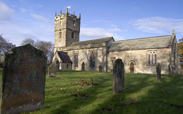 St Martin’s Church, Hayton | |
 | |
 Hayton Location within the East Riding of Yorkshire | |
| Population | 360 (2011 census)[1] |
| OS grid reference | SE819457 |
| • London | 165 mi (266 km) S |
| Civil parish |
|
| Unitary authority |
|
| Ceremonial county |
|
| Region |
|
| Country | England |
| Sovereign state | United Kingdom |
| Post town | YORK |
| Postcode district | YO42 |
| Dialling code | 01759 |
| Police | Humberside |
| Fire | Humberside |
| Ambulance | Yorkshire |
| UK Parliament |
|
The parish includes Burnby together with the hamlet of Thorpe le Street. The parish covers an area of 1,729.333 hectares (4,273.27 acres),[2] According to the 2011 UK census and the parish had a population of 360,[1] an increase on the 2001 UK census figure of 317.[3] Although the civil parish is called "Hayton"[4] its parish council is called "Hayton and Burnby Parish Council".[5] On 1 April 1935 Burnby and Thorpe le Street parish was abolished and merged with Hayton.[6]
The church dedicated to St Martin was designated a Grade I listed building in 1967 and is now recorded in the National Heritage List for England, maintained by Historic England.[7]
In 1823 Hayton was a village and a civil parish in the Wapentake of Harthill. The ecclesiastical parish was Hayton-cum-Beilby, with the parish incumbent living under the patronage of the Dean of York. Population at the time was 177. Occupations included twelve farmers, a blacksmith, a wheelwright, a corn miller, a shoemaker, and the landlord of The White Horse public house.[8]
References
- UK Census (2011). "Local Area Report – Hayton Parish (1170211195)". Nomis. Office for National Statistics. Retrieved 19 February 2018.
- "2001 Census Area Profile" (PDF). East Riding of Yorkshire Council. 2004. Archived (PDF) from the original on 18 March 2012. Retrieved 8 February 2013.
- UK Census (2001). "Local Area Report – Hayton Parish (00FB066)". Nomis. Office for National Statistics. Retrieved 1 March 2020.
- "Hayton". Ordnance Survey. Retrieved 5 February 2021.
- "Home". Hayton and Burnby Parish Council. Retrieved 5 February 2021.
- "Relationships and changes Hayton CP/AP/Ch through time". A Vision of Britain through Time. Retrieved 5 February 2021.
- Historic England. "Church of St. Martin (1084144)". National Heritage List for England. Retrieved 12 August 2013.
- Baines, Edward (1823): History, Directory and Gazetteer of the County of York, p. 214
- Gazetteer – A–Z of Towns Villages and Hamlets. East Riding of Yorkshire Council. 2006. p. 6.
External links
| Authority control |
|
|---|
Другой контент может иметь иную лицензию. Перед использованием материалов сайта WikiSort.org внимательно изучите правила лицензирования конкретных элементов наполнения сайта.
WikiSort.org - проект по пересортировке и дополнению контента Википедии