world.wikisort.org - United_Kingdom
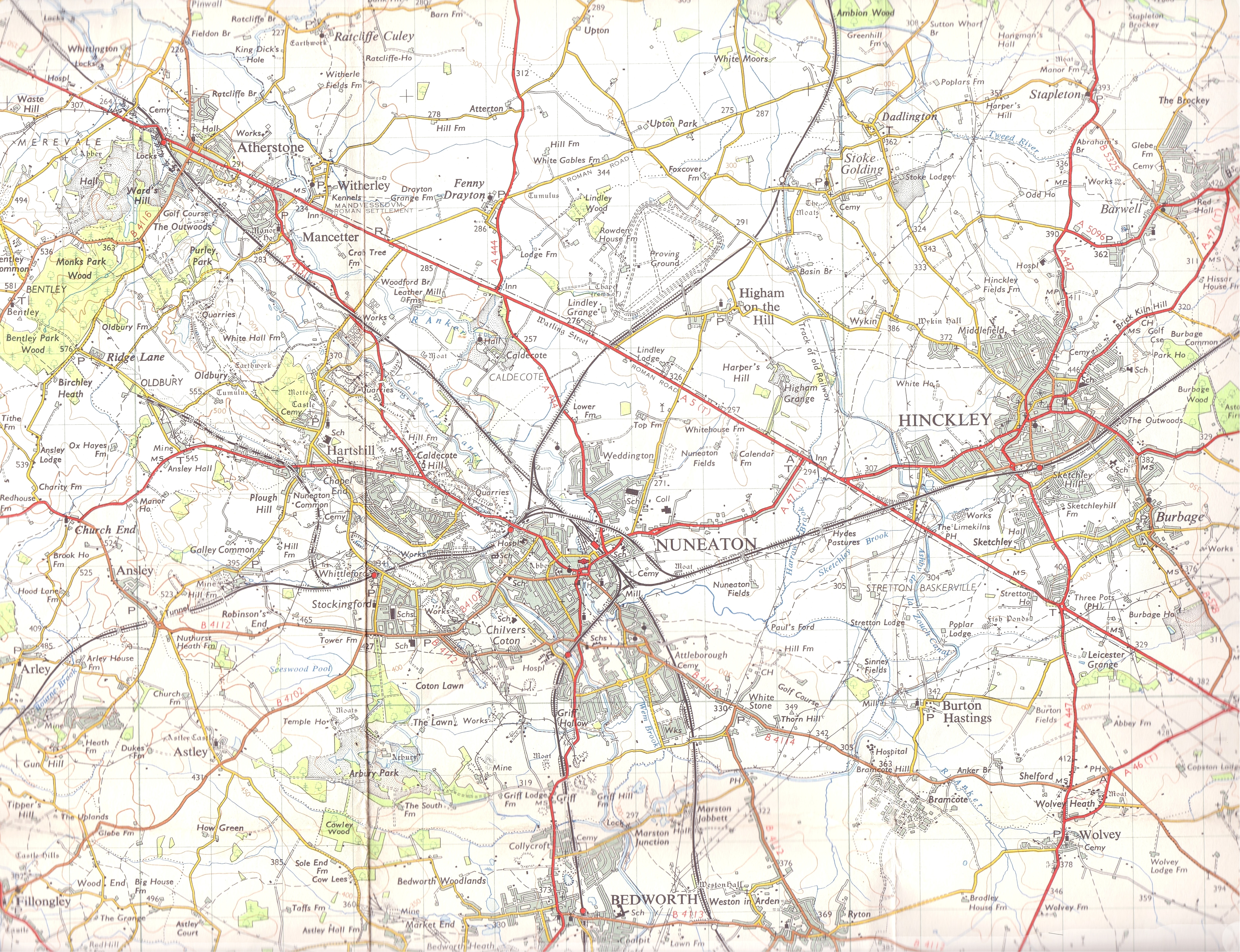
Hartshill is a large village and civil parish in North Warwickshire, England, 2.5 miles (4 km) north-west of the town of Nuneaton. The parish borders the district of Nuneaton and Bedworth at the south, the North Warwickshire district parishes of Ansley at the south-west, Mancetter at the north-west, and Caldecote at the east, and the parish of Witherley in Leicestershire to the north-east from which it is separated by the A5 road. The village is 2.5 miles (4 km) north-west from the town centre of Nuneaton, to which it is conjoined. The market town of Atherstone is 3.5 miles (6 km) to the north-west.
| Hartshill | |
|---|---|
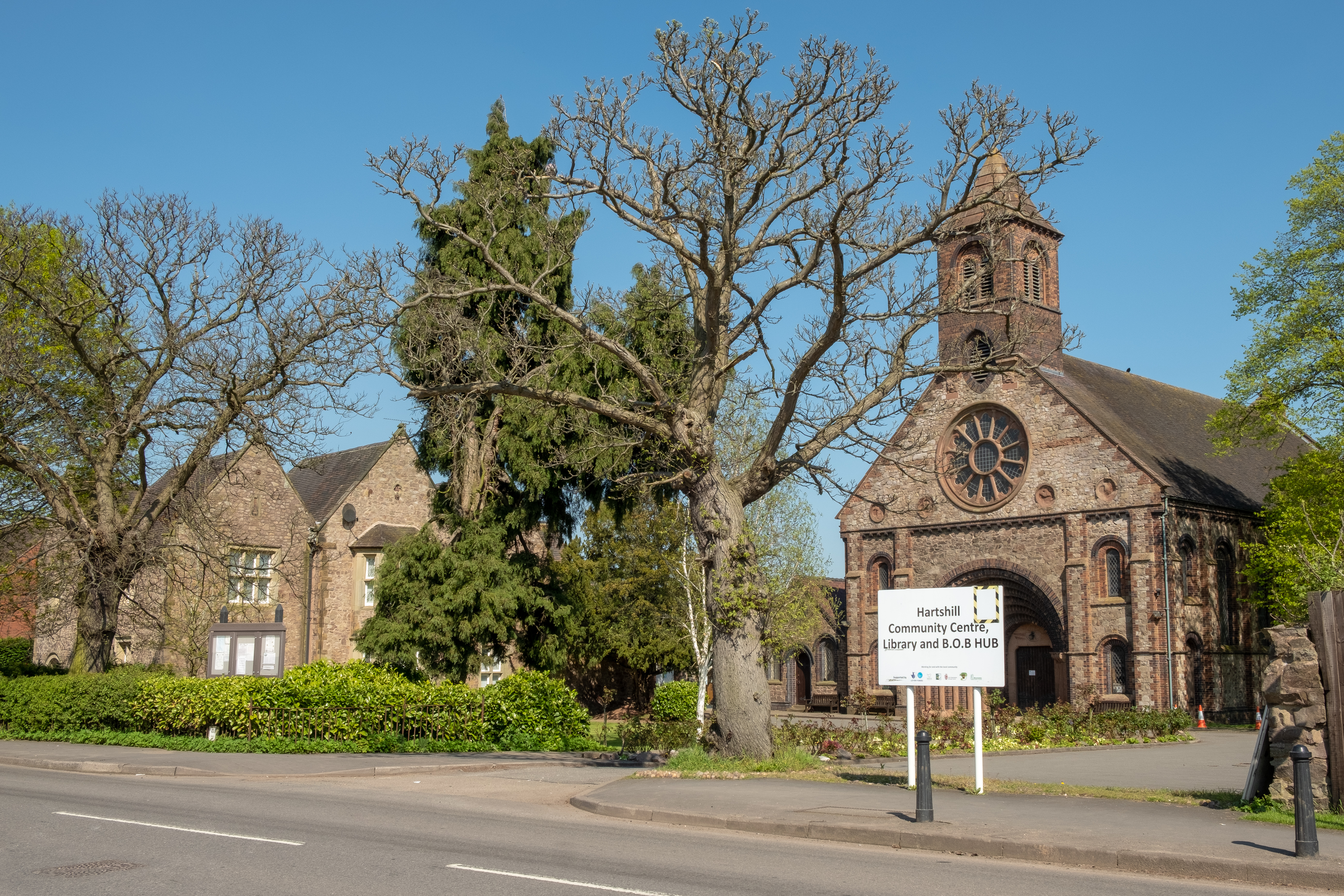 Holy Trinity Church and vicarage, Hartshill | |
 Hartshill Location within Warwickshire | |
| Population | 3,596 (2011 census)[1] |
| OS grid reference | SP326938 |
| • London | 95 mi (153 km) SW |
| Civil parish |
|
| District |
|
| Shire county | |
| Region |
|
| Country | England |
| Sovereign state | United Kingdom |
| Post town | NUNEATON |
| Postcode district | CV10 |
| Police | Warwickshire |
| Fire | Warwickshire |
| Ambulance | West Midlands |
At the 2001 Census, the civil parish of Hartshill had a population of 3,611,[2] decreasing to 3,596 at the 2011 Census.[1] The English poet Michael Drayton, who knew William Shakespeare, was born at Chapel Cottage in Hartshill Green in 1563.[3] Michael Drayton Junior School in Hartshill bears his name. Other schools in the village include Hartshill Academy secondary school. The parish has five pubs: The Stag & Pheasant, Maltshovel, Royal Oak, the Hartshill Club, and The Anchor which is on the Coventry Canal. The Talyllyn Railway locomotive Midlander was purchased in 1957 from Jee's quarries at Hartshill.[4]
References
- UK Census (2011). "Local Area Report – Hartshill Parish (E04009643)". Nomis. Office for National Statistics. Retrieved 28 February 2020.
- UK Census (2001). "Local Area Report – Hartshill Parish (44UB017)". Nomis. Office for National Statistics. Retrieved 28 February 2020.
- Gosse, Edmund William (1911). . Encyclopædia Britannica. Vol. 8 (11th ed.). pp. 557–558.
- Potter 1990, p. 201
Bibliography
- Potter, David (1990). The Talyllyn Railway. David St John Thomas. ISBN 0-946537-50-X.
External links
 Media related to Hartshill at Wikimedia Commons
- Photos of Hartshill and surrounding area on geograph
This Warwickshire location article is a stub. You can help Wikipedia by expanding it. |
Другой контент может иметь иную лицензию. Перед использованием материалов сайта WikiSort.org внимательно изучите правила лицензирования конкретных элементов наполнения сайта.
WikiSort.org - проект по пересортировке и дополнению контента Википедии