world.wikisort.org - United_Kingdom
Halton is a village and former civil parish, now in the parish of Whittington, in the southern part of Northumberland, England. It is situated 3 miles (4.8 km) north of Corbridge just south of Hadrian's Wall. In 1951 the parish had a population of 24.[1]
| Halton | |
|---|---|
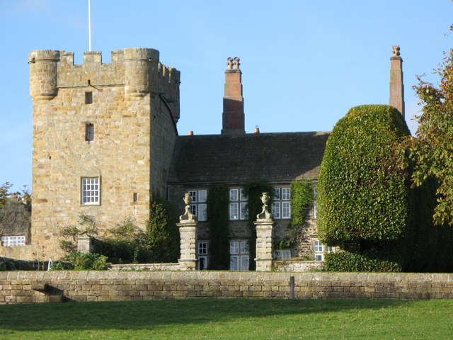 Halton Castle | |
 Halton Location within Northumberland | |
| OS grid reference | NY997677 |
| Civil parish |
|
| Unitary authority |
|
| Ceremonial county |
|
| Region |
|
| Country | England |
| Sovereign state | United Kingdom |
| Post town | CORBRIDGE |
| Postcode district | NE45 |
| Dialling code | 01434 |
| Police | Northumbria |
| Fire | Northumberland |
| Ambulance | North East |
| UK Parliament |
|
Halton Castle is a pele tower and grade I listed building.
Governance
Halton was formerly a township and chapelry in Corbridge parish,[2] from 1866 Halton was a civil parish in its own right until it was abolished on 1 April 1955 to form Whittington.[3]
References
- "Population statistics Halton Tn/CP through time". A Vision of Britain through Time. Retrieved 23 January 2022.
- "History of Halton, in Tynedale and Northumberland". A Vision of Britain through Time. Retrieved 23 January 2022.
- "Relationships and changes Halton Tn/CP through time". A Vision of Britain through Time. Retrieved 15 January 2022.
External links
- GENUKI (Accessed: 27 November 2008)
Wikimedia Commons has media related to Halton, Northumberland.
This Northumberland location article is a stub. You can help Wikipedia by expanding it. |
Текст в блоке "Читать" взят с сайта "Википедия" и доступен по лицензии Creative Commons Attribution-ShareAlike; в отдельных случаях могут действовать дополнительные условия.
Другой контент может иметь иную лицензию. Перед использованием материалов сайта WikiSort.org внимательно изучите правила лицензирования конкретных элементов наполнения сайта.
Другой контент может иметь иную лицензию. Перед использованием материалов сайта WikiSort.org внимательно изучите правила лицензирования конкретных элементов наполнения сайта.
2019-2025
WikiSort.org - проект по пересортировке и дополнению контента Википедии
WikiSort.org - проект по пересортировке и дополнению контента Википедии