world.wikisort.org - United_Kingdom
Great Yeldham is a village in north Essex, England, about 6 miles (10 km) from the Suffolk border. Great Yeldham is situated along the busy main A1017 road (formerly A604) between Braintree and Haverhill.
This article needs additional citations for verification. (August 2007) |
| Great Yeldham | |
|---|---|
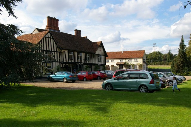 White Hart Hotel, Great Yeldham | |
 Great Yeldham Location within Essex | |
| Population | 1,841 (2011)[1] |
| OS grid reference | TL765385 |
| District |
|
| Shire county |
|
| Region |
|
| Country | England |
| Sovereign state | United Kingdom |
| Post town | HALSTEAD |
| Postcode district | CO9 |
| Dialling code | 01787 |
| Police | Essex |
| Fire | Essex |
| Ambulance | East of England |
| UK Parliament |
|
The village is where the infant River Colne is joined by a stream from near Stambourne and another that has flowed via Toppesfield. The river flows via Colchester on its 39-mile journey to the sea.
Great Yeldham contains the "Great Oak", an old preserved oak tree in the centre of the village, which is claimed to have been recorded in William the Conqueror's Domesday Book of 1086.
In 1967 Great Yeldham elected a Communist councillor, June Cohen, to the surprise of many in the area.[citation needed]
Agriculture
From the 1950s to the 1970s Great Yelham was home to the Whitlock Bros, manufacturers and exporters of Dinkum Diggers (tractors with backhoes and fronthoes, often known these days as 'JCB's). In 1972 Whitlock Bros. was taken over by Hymac, and production subsequently moved to Rhymney in Wales. The Great Yeldham plant closed, resulting in many job losses.
The land around Great Yeldham is principally used for arable farming and some livestock rearing. From the early 1950s until the mid-1980s Great Yeldham was also known for its apple and strawberry farm called Lark Hill Farm, to which people came from miles around to pick their own fruit.
Transport
Until 1962 it was served for passenger traffic by Yeldham railway station on the Colne Valley and Halstead Railway line between Chappel and Wakes Colne and Haverhill. The line crossed what was called Station Road at a level crossing. The road has since been renamed 'Toppesfield Road'.
References
- "Civil Parish population 2011". Neighbourhood Statistics. Office for National Statistics. Retrieved 3 September 2016.
External links
- St. Andrew's Primary School (Great Yeldham) Website
- Website for St. Andrew’s Church, Great Yeldham, part of the Upper Colne Valley Parishes
This Essex location article is a stub. You can help Wikipedia by expanding it. |
На других языках
- [en] Great Yeldham
[ru] Грейт-Йелдем
Грейт Йелдем (англ. Great Yeldham) — деревня в Англии, графство Эссекс. Грейт Йелдем находится в десяти километрах от границы с графством Саффолк. Среди близлежащих деревень и городов числятся: Литл Йелдем, Топпесфилд, Стамберн, Риджвелл. Деревня располагается рядом с оживленной трассой A1017, которая связывает такие крупные города, как Брейнтри и Хаверхилл. Приходская церковь деревни насчитывает 726 прихожан, и имеет в своих владениях 4046 км² земли[1].Другой контент может иметь иную лицензию. Перед использованием материалов сайта WikiSort.org внимательно изучите правила лицензирования конкретных элементов наполнения сайта.
WikiSort.org - проект по пересортировке и дополнению контента Википедии