world.wikisort.org - United_Kingdom
Elloughton is a village in the East Riding of Yorkshire, England. It is situated approximately 12 miles (19 km) to the west of Hull to the south of the A63 road. It lies on the southern end of the Yorkshire Wolds. It is conjoined with Brough that lies to the south-east, with which it forms the civil parish of Elloughton-cum-Brough.
| Elloughton | |
|---|---|
 Welton Low Road, Elloughton | |
 Elloughton Location within the East Riding of Yorkshire | |
| OS grid reference | SE942280 |
| • London | 155 mi (249 km) S |
| Civil parish |
|
| Unitary authority |
|
| Ceremonial county |
|
| Region |
|
| Country | England |
| Sovereign state | United Kingdom |
| Post town | BROUGH |
| Postcode district | HU15 |
| Dialling code | 01482 |
| Police | Humberside |
| Fire | Humberside |
| Ambulance | Yorkshire |
| UK Parliament |
|
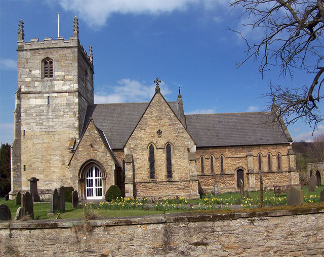
Elloughton lies within the Parliamentary constituency of Haltemprice and Howden.[1] The church dedicated to St Mary was designated a Grade II* listed building in 1968 and is now recorded in the National Heritage List for England, maintained by Historic England.[2]

In 1823, Elloughton was in the Wapentake of Harthill, a part of the Liberty of St Peter's. The patron of the Church of St Mary was the York Minster prebendary of Wetwang. Within the village was a Methodist and a Calvinist chapel. The village had a population of 318, with occupations including six farmers, two carpenters, two tailors, a blacksmith, a shoemaker, and a bricklayer. Also directory-listed were three yeomen, a school master, a gentlewoman, and a curate. Once a week two carriers operated between the village and Hull.[3]
References
- "Haltemprice and Howden". UK Polling Report. Retrieved 11 May 2015.
- Historic England. "Church of St Mary (1203258)". National Heritage List for England. Retrieved 17 August 2013.
- Baines, Edward (1823). History, Directory and Gazetteer of the County of York. p. 201.
- Gazetteer — A–Z of Towns Villages and Hamlets. East Riding of Yorkshire Council. 2006. p. 5.
External links
 Media related to Elloughton at Wikimedia Commons
- Elloughton in the Domesday Book
This East Riding of Yorkshire location article is a stub. You can help Wikipedia by expanding it. |
Другой контент может иметь иную лицензию. Перед использованием материалов сайта WikiSort.org внимательно изучите правила лицензирования конкретных элементов наполнения сайта.
WikiSort.org - проект по пересортировке и дополнению контента Википедии