world.wikisort.org - United_Kingdom
East Cottingwith is a village and former civil parish, now in the parish of Cottingwith, East Riding of Yorkshire, England. It lies on the former Derwent Navigation (canal), and approximately 9 miles (14 km) north-west of the market town of Howden and 7 miles (11 km) south-west of the market town of Pocklington. The village is 1 mile (1.6 km) west of the B1228 road and just east of the River Derwent. In 1931 the civil parish had a population of 185.[2] On 1 April 1935 the civil parish was merged with Storwood to create Cottingwith.[3]
| East Cottingwith | |
|---|---|
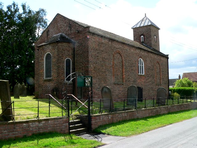 St Mary’s Church | |
 East Cottingwith Location within the East Riding of Yorkshire | |
| Population | 349 (2011 census)[1] |
| OS grid reference | SE703423 |
| • London | 165 mi (266 km) S |
| Civil parish |
|
| Unitary authority |
|
| Ceremonial county |
|
| Region |
|
| Country | England |
| Sovereign state | United Kingdom |
| Post town | YORK |
| Postcode district | YO42 |
| Dialling code | 01759 |
| Police | Humberside |
| Fire | Humberside |
| Ambulance | Yorkshire |
| UK Parliament |
|
The civil parish of Cottingwith is formed by the village of East Cottingwith and the hamlet of Storwood. According to the 2011 UK Census, Cottingwith parish had a population of 349,[1] an increase on the 2001 UK Census figure of 290.[4]
The village church is St Mary's and is a Grade II listed building.[5]
Gallery
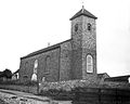 St Mary's Church, 1900–1912
 The village street, 1900–1912
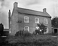 Ferry Boat Inn, 1900–1912
 Narrowboat at Cottingwith Lock, near East Cottingwith
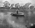 View of the river near East Cottingwith, 1900–1912


References
- UK Census (2011). "Local Area Report – Cottingwith Parish (1170211165)". Nomis. Office for National Statistics. Retrieved 16 February 2018.
- "Population Statistics East Cottingwith Ch/CP through time". Vision of Britain. Retrieved 16 June 2018.
- "Relationships and changes Cottingwith CP through time". Vision of Britain. Retrieved 16 June 2018.
- UK Census (2001). "Local Area Report – Cottingwith Parish (1543504211)". Nomis. Office for National Statistics. Retrieved 6 December 2018.
- Historic England. "Church of St Mary (1309872)". National Heritage List for England. Retrieved 19 October 2014.
- Gazetteer — A–Z of Towns Villages and Hamlets. East Riding of Yorkshire Council. 2006. p. 5.
External links
 Media related to East Cottingwith at Wikimedia Commons
- East Cottingwith in the Domesday Book
Authority control | |
|---|---|
| General |
|
| National libraries | |
This East Riding of Yorkshire location article is a stub. You can help Wikipedia by expanding it. |
Другой контент может иметь иную лицензию. Перед использованием материалов сайта WikiSort.org внимательно изучите правила лицензирования конкретных элементов наполнения сайта.
WikiSort.org - проект по пересортировке и дополнению контента Википедии