world.wikisort.org - United_Kingdom
Dunston is a small village which lies approximately 3 miles south of Norwich. The population is included in the civil parish of Stoke Holy Cross. It is located in the valley of the River Tas between Stoke Holy Cross and Caistor St. Edmund. It has a common which is popular with walkers.[1]
| Dunston | |
|---|---|
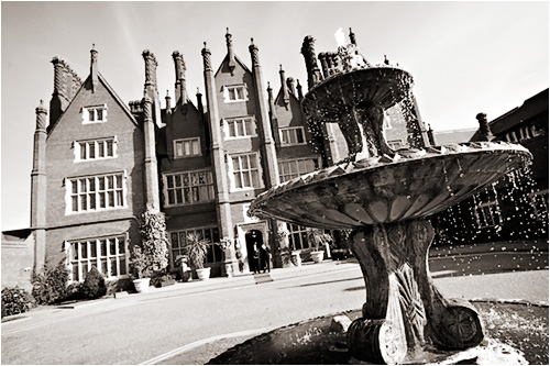 Dunston Hall | |
| OS grid reference | TG 227 025 |
| Civil parish | |
| District |
|
| Shire county |
|
| Region |
|
| Country | England |
| Sovereign state | United Kingdom |
| Post town | Norwich |
| Postcode district | NR14 |
The villages name means 'Dun(n)(i)'s farm/settlement'.
Parish records for Dunston exist as far back as 1557[2] but the village is now in the civil parish of Stoke Holy Cross.
Dunston Hall is now a hotel.
Notes
- "Dunston Common". South Norfolk Council. Retrieved 20 June 2009.
- "Norfolk: Dunston". Genuki Norfolk. February 2002. Retrieved 26 June 2009.
http://kepn.nottingham.ac.uk/map/place/Norfolk/Dunston
External links
- Dunston Hall
- Map sources for Dunston, Norfolk
![]() Media related to Dunston, Norfolk at Wikimedia Commons
Media related to Dunston, Norfolk at Wikimedia Commons
This Norfolk location article is a stub. You can help Wikipedia by expanding it. |
Текст в блоке "Читать" взят с сайта "Википедия" и доступен по лицензии Creative Commons Attribution-ShareAlike; в отдельных случаях могут действовать дополнительные условия.
Другой контент может иметь иную лицензию. Перед использованием материалов сайта WikiSort.org внимательно изучите правила лицензирования конкретных элементов наполнения сайта.
Другой контент может иметь иную лицензию. Перед использованием материалов сайта WikiSort.org внимательно изучите правила лицензирования конкретных элементов наполнения сайта.
2019-2026
WikiSort.org - проект по пересортировке и дополнению контента Википедии
WikiSort.org - проект по пересортировке и дополнению контента Википедии