world.wikisort.org - United_Kingdom
Conistone is a small village in the Craven district of North Yorkshire, England. It lies 3 miles (5 km) north of Grassington, 3 miles (5 km) south of Kettlewell and 12 miles (19 km) north of Skipton beside the River Wharfe, in Upper Wharfedale.[1]
| Conistone | |
|---|---|
 Conistone, bridge and Dib, over Wharfedale from west | |
 Conistone Location within North Yorkshire | |
| OS grid reference | SD981675 |
| Civil parish |
|
| District |
|
| Shire county |
|
| Region |
|
| Country | England |
| Sovereign state | United Kingdom |
| Post town | SKIPTON |
| Postcode district | BD23 |
| Dialling code | 01756 |
| Police | North Yorkshire |
| Fire | North Yorkshire |
| Ambulance | Yorkshire |
| UK Parliament |
|
History
Conistone is mentioned in the Domesday Book as Cunestune and belonging to Ketil.[2] The name derives from a mix of Old Danish (Kunung) and Old English (tūn), which means King's farm or Settlement.[3]
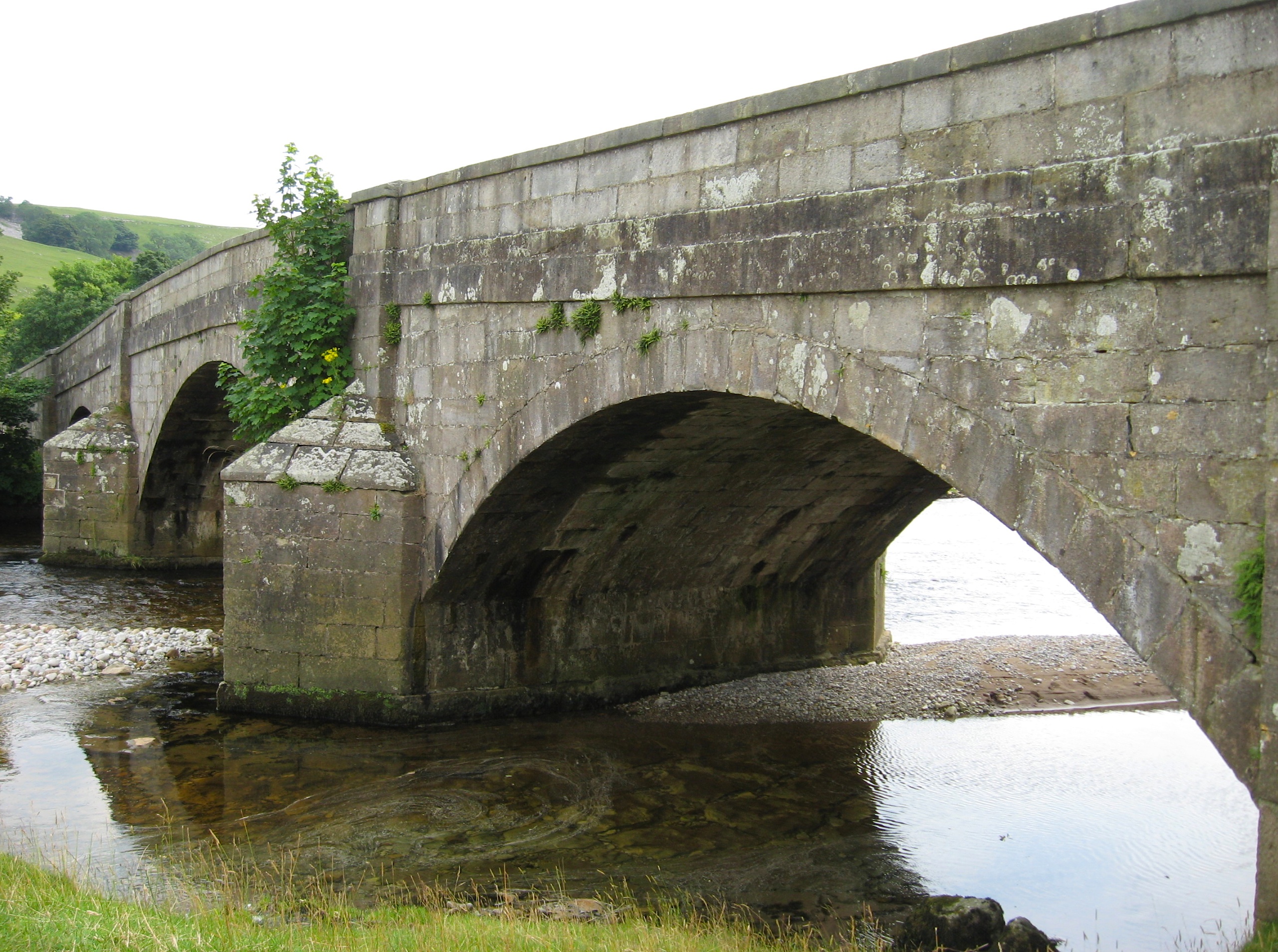
The village is set in characteristic limestone scenery, including Mossdale Caverns, the dry gorge of Conistone Dib and the limestone outcrop of Conistone Pie.[4] Above the Dib the Dales Way path connects Kettlewell, to its north, and Grassington, to its south, providing distant views over Wharfedale.[5] From the B6160 road, the Wharfe is crossed at Conistone by a stone-arch bridge,[6] which is within easy walking distance of Kilnsey, with its Crag.
The parish church, St Mary's Church, dates from the 11th or 12th century, and is a Grade II listed building.[7]
Conistone was historically in the large ancient parish of Burnsall, in Staincliffe Wapentake in the West Riding of Yorkshire.[8] It became part of the civil parish of Conistone with Kilnsey in 1866,[9] and was transferred to North Yorkshire in 1974. The population of the parish in the 2001 census was 117,[10] rising to 124 at the 2011 census.[11] In 2015, North Yorkshire County Council had estimated the population to be 110.[12]
Immediately to the east of the village lies Conistone Moor and Riggs Moor. The moorland here was known for its lead mines,[13] and also as being the furthest point in England from a road. Known by the Ordnance Survey as Pile of Stones, the point is on Riggs Moor and is found at 54.1427°N 1.9585°W, SE03287183.[14]
Gallery
 St Mary's Church, Conistone, from the south-east
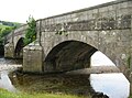 Stone arch bridge over Wharfe
 Meadowsweet along B6160, toward Kilnsey
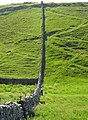 Wall across Dib
 View down Dib from top, at Dales Way path
 Conistone Dib


References
- "Genuki: In 1822, the following places were in the Parish of Burnsall:, Yorkshire (West Riding)". www.genuki.org.uk. Retrieved 6 January 2020.
- "Conistone | Domesday Book". opendomesday.org. Retrieved 6 January 2020.
- Ekwall, Eilert (1960). The concise Oxford dictionary of English place-names (4 ed.). Oxford: Oxford University Press. p. 120. ISBN 0-19-869103-3.
- Machell, Ben (22 May 2009). "Times Walks: Kettlewell and Conistone Moor, North Yorkshire". The Times. Retrieved 6 January 2020.
- "Weekend Walk. Conistone Dib". The Yorkshire Post. 7 October 2017. Retrieved 6 January 2020.
- Historic England. "Conistone Bridge over River Wharfe (Grade II) (1316801)". National Heritage List for England. Retrieved 6 January 2020.
- Historic England. "Church of St Mary (1296267)". National Heritage List for England. Retrieved 21 June 2015.
- "Places in the Parish of Burnsall in 1822". GENUKI. Retrieved 12 June 2013.
- "Conistone With Kilnsey CP/Ch". Vision of Britain. Retrieved 12 June 2013.
- UK Census (2001). "Local Area Report – Conistone with Kilnsey Parish (36UB020)". Nomis. Office for National Statistics. Retrieved 6 January 2020.
- UK Census (2011). "Local Area Report – Conistone with Kilnsey Parish (E04007073)". Nomis. Office for National Statistics. Retrieved 6 January 2020.
- "2015 Population Estimates Parishes" (PDF). northyorks.gov.uk. December 2016. p. 10. Retrieved 6 January 2020.
- "The Yorkshire Moors and Fells" (PDF). yorkshiredales.org.uk. p. 2. Retrieved 6 January 2020.
- Hellen, Nicholas (26 May 2019). "The end of Britain's wilderness: nowhere is more than 6 miles from a road". The Sunday Times. Retrieved 6 January 2020.
External links
Другой контент может иметь иную лицензию. Перед использованием материалов сайта WikiSort.org внимательно изучите правила лицензирования конкретных элементов наполнения сайта.
WikiSort.org - проект по пересортировке и дополнению контента Википедии