world.wikisort.org - United_Kingdom
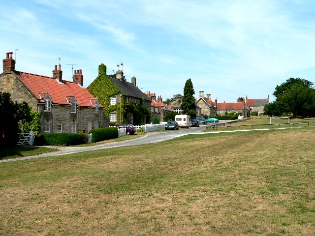
Coneysthorpe is a small village and civil parish in the Ryedale district of North Yorkshire, England. It is situated near Castle Howard and 4 miles (6.4 km) west of Malton. The Centenary Way long-distance path runs through the village.
| Coneysthorpe | |
|---|---|
 Coneysthorpe Location within North Yorkshire | |
| Population | 120 (2011 census)[1] |
| OS grid reference | SE712712 |
| Civil parish |
|
| District |
|
| Shire county |
|
| Region |
|
| Country | England |
| Sovereign state | United Kingdom |
| Post town | YORK |
| Postcode district | YO60 |
| Police | North Yorkshire |
| Fire | North Yorkshire |
| Ambulance | Yorkshire |
| UK Parliament |
|
References
- UK Census (2011). "Local Area Report – Coneysthorpe Parish (E04007564)". Nomis. Office for National Statistics. Retrieved 19 July 2020.
External links
![]() Media related to Coneysthorpe at Wikimedia Commons
Media related to Coneysthorpe at Wikimedia Commons
This Ryedale location article is a stub. You can help Wikipedia by expanding it. |
Текст в блоке "Читать" взят с сайта "Википедия" и доступен по лицензии Creative Commons Attribution-ShareAlike; в отдельных случаях могут действовать дополнительные условия.
Другой контент может иметь иную лицензию. Перед использованием материалов сайта WikiSort.org внимательно изучите правила лицензирования конкретных элементов наполнения сайта.
Другой контент может иметь иную лицензию. Перед использованием материалов сайта WikiSort.org внимательно изучите правила лицензирования конкретных элементов наполнения сайта.
2019-2025
WikiSort.org - проект по пересортировке и дополнению контента Википедии
WikiSort.org - проект по пересортировке и дополнению контента Википедии