world.wikisort.org - United_Kingdom
Coal Aston is a village in the county of Derbyshire, in England. It is by the town of Dronfield.[1][2][3]
| Coal Aston | |
|---|---|
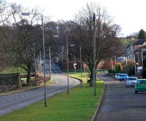 Looking east along Eckington Road in the direction of Chesterfield | |
 Coal Aston Location within Derbyshire | |
| OS grid reference | SK362795 |
| District | |
| Shire county | |
| Region | |
| Country | England |
| Sovereign state | United Kingdom |
| Post town | DRONFIELD |
| Postcode district | S18 |
| Dialling code | 01246 |
| Police | Derbyshire |
| Fire | Derbyshire |
| Ambulance | East Midlands |
| UK Parliament |
|
Geography
Coal Aston sits on a ridge overlooking Sheffield and Dronfield. To the south there is Frith Wood, which is made up of mixed woodland rich in many species of fauna and flora and is thought to be an ancient wood. The wood is now a conservation area and although it is spelt Frith Wood on, for example, Ordnance Survey maps many locals call it Firth wood as in the neighbouring Firthwood Road.The wood is now popular for the William Hale trail. [4] The name Coal Aston is due to the a number of walk in coal mine in the area, finally closing in 1938. There are many stone built houses and terraces dating back to the mining era during the 19th century. That last mine Sicklebrook Colliery on Sicklebrook Lane (off Eckington Road) closed in 1938.[5] There still an Aston Hall in the centre of the village. The large Victorian village school has now been converted into a private house. During World War II the village was the sight of a prisoner-of-war camp.[6]

References
- Coal Aston Conservation Area: Character Statement. Department of Development & Leisure. 2003.
- Messer, E. (1998). Weslyan Reform Church Coal Aston 1848-1998: The Story of the Wesleyan Reform Chapel. Accent Print & Design.
- Kelly's Directories, ltd (1854). Post office directory of Sheffield with the neighbouring towns and villages [afterw.] Kelly's directory of Sheffield & Rotherham and neighbourhood.
- Google maps, see firth woods
- Office, Great Britain Home (1889). List of Plans of the Abandoned Mines: Deposited in the Home Office Under the Coal and Metalliferous Mines Regulation Acts. H.M. Stationery Office.
- Warr, Peter (30 August 2015). Sheffield's Great War and Beyond, 1916–1918. Pen and Sword. ISBN 978-1-4738-6925-7.
External links
- Coal Aston in the Domesday Book
Другой контент может иметь иную лицензию. Перед использованием материалов сайта WikiSort.org внимательно изучите правила лицензирования конкретных элементов наполнения сайта.
WikiSort.org - проект по пересортировке и дополнению контента Википедии