world.wikisort.org - United_Kingdom
Burnby is a village and former civil parish, now in the parish of Hayton, in the East Riding of Yorkshire, England. It is situated approximately 2.5 miles (4 km) south-east of the market town of Pocklington and 4 miles (6.4 km) north-west of the market town of Market Weighton. It lies 1 mile (1.6 km) to the east of the A1079 road. In 1931 the parish had a population of 103.[1] On 1 April 1935 the parish was abolished and merged with Hayton.[2]
| Burnby | |
|---|---|
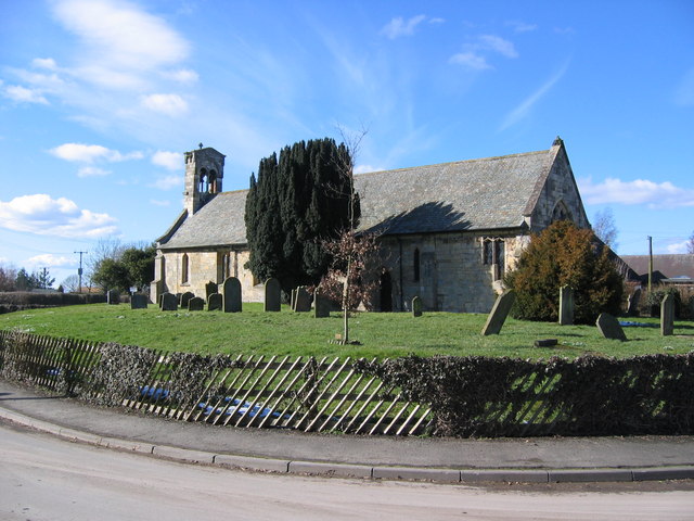 St Giles Church, Burnby | |
 Burnby Location within the East Riding of Yorkshire | |
| OS grid reference | SE836464 |
| • London | 165 mi (266 km) S |
| Civil parish | |
| Unitary authority |
|
| Ceremonial county |
|
| Region |
|
| Country | England |
| Sovereign state | United Kingdom |
| Post town | YORK |
| Postcode district | YO42 |
| Dialling code | 01759 |
| Police | Humberside |
| Fire | Humberside |
| Ambulance | Yorkshire |
| UK Parliament |
|
The church dedicated to St Giles was designated a Grade II* listed building in 1967 and is now recorded in the National Heritage List for England, maintained by Historic England.[3]
Burnby was served by Nunburnholme railway station on the York to Beverley Line between 1847 and 1951.[4]
References
- "Population statistics Burnby CP/AP through time". A Vision of Britain through Time. Retrieved 5 February 2021.
- "Relationships and changes Burnby CP/AP through time". A Vision of Britain through Time. Retrieved 5 February 2021.
- Historic England. "Church of Saint Giles (1084145)". National Heritage List for England. Retrieved 16 August 2013.
- Butt, R. V. J. (October 1995). The Directory of Railway Stations: details every public and private passenger station, halt, platform and stopping place, past and present (1st ed.). Sparkford: Patrick Stephens Ltd. ISBN 978-1-85260-508-7. OCLC 60251199. OL 11956311M.
- Gazetteer — A–Z of Towns Villages and Hamlets. East Riding of Yorkshire Council. 2006. p. 4.
External links
This East Riding of Yorkshire location article is a stub. You can help Wikipedia by expanding it. |
Другой контент может иметь иную лицензию. Перед использованием материалов сайта WikiSort.org внимательно изучите правила лицензирования конкретных элементов наполнения сайта.
WikiSort.org - проект по пересортировке и дополнению контента Википедии