world.wikisort.org - United_Kingdom
Brora (/ˈbrɔːrə/ BRAW-rə, Scottish Gaelic: Brùra) is a village in the east of Sutherland, in the Highland area of Scotland.
Brora
| |
|---|---|
 Harbour Road, Brora | |
 Brora Location within the Sutherland area | |
| Population | 1,210 (mid-2020 est.)[1] |
| OS grid reference | NC906039 |
| Council area | |
| Lieutenancy area |
|
| Country | Scotland |
| Sovereign state | United Kingdom |
| Post town | BRORA |
| Postcode district | KW9 |
| Dialling code | 01408 |
| Police | Scotland |
| Fire | Scottish |
| Ambulance | Scottish |
| UK Parliament | |
| Scottish Parliament |
|


Origin of the name
The name Brora is derived from Old Norse and means "river with a bridge".[2]
History
Brora is a small industrial village, having at one time a coal pit, boat building, salt pans, fish curing, lemonade factory, the new Clynelish Distillery (as well as the old Clynelish distillery which is now called the Brora distillery [3]), wool mill, bricks and a stone quarry. The white sandstone in the Clynelish quarry belongs to the Brora Formation, of the Callovian and Oxfordian stages (formerly Middle Oolite) of the Mid-Late Jurassic. Stone from the quarry was used in the construction of London Bridge, Liverpool Cathedral and Dunrobin Castle. When in operation, the coalmine was the most northerly coalmine in the UK. Brora was the first place in the north of Scotland to have electricity thanks to its wool industry. This distinction gave rise to the local nickname of "Electric City" at the time. Brora also houses a baronial style clock tower which is a war memorial.
Archaeology
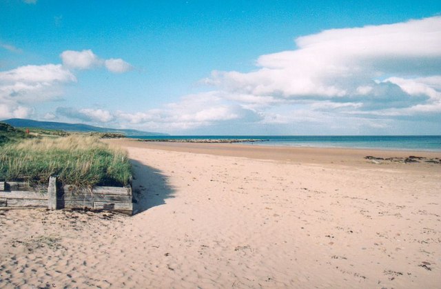
In 2005, members of the Clyne Heritage Society (CHS) monitored structures eroding from the dunes on the Back Beach, south of the harbour. This was a pilot project for the Shorewatch programme, which aimed to train community groups to search for new archaeological sites and record information on them to be passed on to local and national archives. CHS members found a map, dated 1812, which depicts ‘Old Salt Pans’ marked at the position of the eroding structures. They also found records showing that the ‘Old Salt Pans’ were constructed in 1598 but had gone out of use within a few years.[4]
Transport
The village is situated where the A9 road and the Far North Line bridge the River Brora. The village is served by a railway station. Buses operate about every two hours Mondays-Saturdays and infrequently on Sundays from Brora to Golspie, Dornoch, Tain and Inverness in the south and Helmsdale, Dunbeath, Lybster, Wick, Castletown, Thurso and Scrabster in the north. These are on routes X98, and X99 and are operated by Stagecoach in the Highlands.
Education
An education is available for primary school children in Brora Primary School in Johnstone Place. The building was formerly Brora High School, that included the primary department. Although the school opened in 1962, the secondary department closed in 1985. It includes a playgroup, nursery and Primaries 1 to 7. Older children are taken by school transportation to the nearby Golspie High School.[5]
Sport
Brora Rangers F.C. were founded in 1879 and have been members of the Highland Football League since 1962. They moved to their present stadium, Dudgeon Park, in 1922. Amongst the local amenities are an 18-hole links golf course designed by James Braid in 1923 for sum of £23, bowling and tennis facilities.
Government listening station
To the south-east of the village is the former Brora Y Station which operated as a Government listening station between 1940 and 1986.[6]
Notable people from Brora
- Megan Boyd (1915–2001), fly-tier.[7]
- Rev Prof William John Cameron, twice Moderator of the General Assembly of the Free Church of Scotland
- Isabella Gordon Mackay was born near here in the 1770s. She created support for Presbyterians in Nova Scotia sending teachers, ministers and more.[8]
References
- "Mid-2020 Population Estimates for Settlements and Localities in Scotland". National Records of Scotland. 31 March 2022. Retrieved 31 March 2022.
- Field, John (1984). Discovering Place Names. Shire Publications. ISBN 978-0852637029.
- "Brora". The Wiskey Guide. Archived from the original on 2 April 2009.
- "Vol 48 (2011): Aeolian archaeology: the archaeology of sand landscapes in Scotland | Scottish Archaeological Internet Reports". journals.socantscot.org. Retrieved 21 August 2021.
- "Golspie High School Catchment Area Map - Rezzio". 14 May 2015. Archived from the original on 11 August 2016. Retrieved 23 June 2016.
- "How Cheltenham entered America's backyard". New Scientist. 5 April 1984. Archived from the original on 27 December 2014. Retrieved 12 December 2014.
- "Megan Boyd". www.scotsman.com. Archived from the original on 25 October 2017. Retrieved 20 June 2019.
- Stanley-Blackwell, Laurie C. C.; MacLennan, Jean M. (2004). "Mackay, Isabella Gordon [Bella] (1777/8–1850), philanthropist and religious activist". Oxford Dictionary of National Biography (online ed.). Oxford University Press. doi:10.1093/ref:odnb/59558. Retrieved 15 August 2020. (Subscription or UK public library membership required.)
External links
| Wikimedia Commons has media related to Brora. |
| Authority control |
|
|---|
На других языках
[de] Brora (Schottland)
Brora (gälisch: Brùra oder Inbhir Bhrùra[1]) ist ein Dorf in der schottischen Council Area Highland. Es liegt an der Nordseeküste an der Mündung des Flusses Brora in der traditionellen Grafschaft Sutherland etwa 35 km nordöstlich von Invergordon und 60 km südwestlich von Wick.[2] Im Jahre 2011 verzeichnete Brora 1282 Einwohner.[3]- [en] Brora
Другой контент может иметь иную лицензию. Перед использованием материалов сайта WikiSort.org внимательно изучите правила лицензирования конкретных элементов наполнения сайта.
WikiSort.org - проект по пересортировке и дополнению контента Википедии