world.wikisort.org - United_Kingdom
Black Horse Drove is a linear hamlet that lies 7 miles (11 km) north-north-east of Ely in Cambridgeshire, England in the civil parish of Littleport . Black Horse Drove is located off the Ten Mile Bank, a long road which runs alongside the north-western bank of the river Great Ouse between Littleport and Southery in Norfolk.
| Black Horse Drove | |
|---|---|
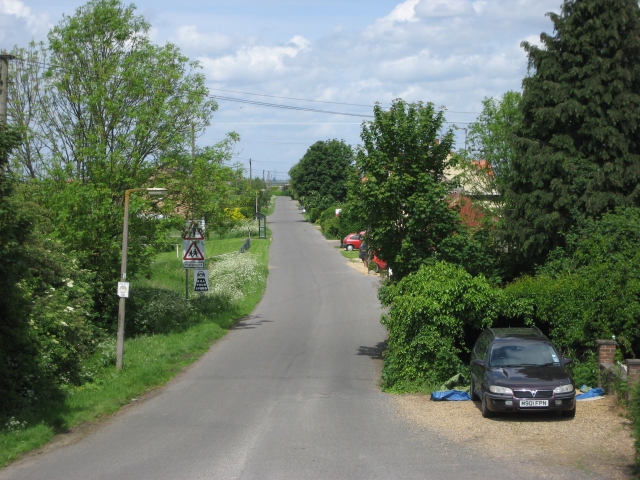 Black Horse Drove viewed from junction with Ten Mile Bank | |
 Black Horse Drove Location within Cambridgeshire | |
| OS grid reference | TL5991 |
| • London | 71 miles (114 km) |
| District |
|
| Shire county |
|
| Region |
|
| Country | England |
| Sovereign state | United Kingdom |
| Post town | Ely |
| Postcode district | CB6 |
| UK Parliament |
|
Black Horse Drove is in the Fens and much of the village is around 6 feet (1.8 m) below sea level.
The estimated population of Black Horse Drove in 2010 was 220 in 93 dwellings.[1]
Facilities
A Wesleyan chapel was built in 1843[2] and rebuilt in 1897 but it has now been converted to a private residence.
A school was built in Black Horse Drove c.1874 but due to overcrowding and its dangerous condition, a new school called the Coronation County Primary Junior and Infants School was built in 1937.[2] The old school was used as a community centre until 2008 when it was acquired by Littleport Parish Council and then refurbished. The community centre re-opened on 15 October 2011.[3]
The Black Horse public house was built c.1912 but has closed and is now a private residence.
In Black Horse Drove there is also a children's play area and a playing field.
Transport
There is a weekly bus service on Thursday mornings which leaves at 09:30 to Littleport, Prickwillow and Ely and returns at around 13:30
The nearest railway station is 5 miles (8.0 km) away at Littleport.
References
- "Black Horse Drove Village Vision (draft)" (PDF). East Cambs District Council. Retrieved 9 December 2015.
- Atkinson, T D; Hampson, Ethel M; Long, E T; Miller, Edward; Wells, H B; Woodgate, G M G. "Ely Hundred:Littleport in A History of the County of Cambridgeshire and the Isle of Ely: Volume 4, City of Ely; Ely, N. and S. Witchford and Wisbech Hundreds". British History Online. Retrieved 9 December 2015.
- "New Centre Opens at Black Horse Drove". Eastern Daily Press. Retrieved 9 December 2015.
External links
This Cambridgeshire location article is a stub. You can help Wikipedia by expanding it. |
Другой контент может иметь иную лицензию. Перед использованием материалов сайта WikiSort.org внимательно изучите правила лицензирования конкретных элементов наполнения сайта.
WikiSort.org - проект по пересортировке и дополнению контента Википедии