world.wikisort.org - United_Kingdom
Axford is a hamlet in the Kennet Valley about 3 miles (4.8 km) east of Marlborough in the English county of Wiltshire.
| Axford | |
|---|---|
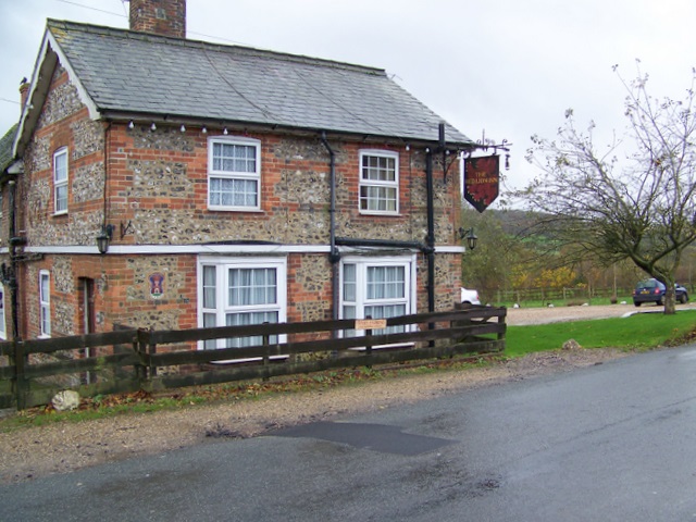 The Red Lion Inn | |
 Axford Location within Wiltshire | |
| OS grid reference | SU2370 |
| Civil parish |
|
| Unitary authority |
|
| Ceremonial county |
|
| Region | |
| Country | England |
| Sovereign state | United Kingdom |
| Post town | Marlborough |
| Postcode district | SN8 |
| Dialling code | 01672 |
| Police | Wiltshire |
| Fire | Dorset and Wiltshire |
| Ambulance | South Western |
| UK Parliament |
|
| Website | Ramsbury & Axford Community |
History
Axford was one of seven Saxon settlements along the Kennet Valley in modern-day Wiltshire in the 5th and 6th centuries.[1]
During the 15th and 16th century, Axford Manor was centred on Priory Farm a short distance from the village itself. The majority of housing was built to the south of the main road through the village; the area to the north was developed during the late 18th and early 19th century.[2]
St Michael's church was built in 1856 to designs of William White, as a chapel of ease to Holy Cross at Ramsbury.[3]
A military camp was sited near Axford during the Second World War.[4]
Buildings
Axford has one listed building, the Grade I listed Axford Farmhouse which has medieval origins.[5] There is also The Red Lion public house, a 17th-century building.[6]
Local government
Axford is in Ramsbury civil parish; the parish council styles itself as Ramsbury & Axford Parish Council.[7] The second tier of local government is Wiltshire Council. The two councils are responsible for different aspects of local government.
Transport
Axford is close to the A4 road.[6] Bus services to the village are provided by Swindon's Bus Company route 48 between Swindon and Marlborough.[8]
References
- Wiltshire County - Council Community and Parish information for Ramsbury Archived 20 March 2012 at the Wayback Machine
- Chandler, John (2001). "Ramsbury Concise History". Marlborough and Eastern Wiltshire. Hobnob Press. ISBN 0-946418-07-1. Archived from the original on 20 March 2012. Retrieved 4 February 2011.
- "Church of St. Michael, Axford, Ramsbury". Wiltshire Community History. Wiltshire Council. Retrieved 28 November 2019.
- Flying Troops to Camp The Leader Post, 1 September 1939
- Historic England. "Axford Farmhouse (1300471)". National Heritage List for England. Retrieved 28 November 2019.
- (From The Wiltshire Gazette and Herald)
- "Ramsbury and Axford Parish Council, accessed 13 March 2013". Archived from the original on 23 August 2013. Retrieved 13 March 2013.
- Thamesdown Transport - Timetables - Route 46/46A/48 Archived 24 December 2010 at the Wayback Machine
Further reading
- Baggs, A.P.; Freeman, Jane; Stevenson, Janet H (1983). Crowley, D.A. (ed.). "Victoria County History – Wiltshire – Vol 12 pp47-52 – Parishes: Axford". British History Online. University of London. Retrieved 2 December 2019.
External links
![]() Media related to Axford, Wiltshire at Wikimedia Commons
Media related to Axford, Wiltshire at Wikimedia Commons
This article about a location in Wiltshire is a stub. You can help Wikipedia by expanding it. |
Другой контент может иметь иную лицензию. Перед использованием материалов сайта WikiSort.org внимательно изучите правила лицензирования конкретных элементов наполнения сайта.
WikiSort.org - проект по пересортировке и дополнению контента Википедии