world.wikisort.org - United_Kingdom
Achintee (Scottish Gaelic: Achadh an t-Suidhe) is a location in Glen Nevis in the Highland council area of Scotland. It is around 2 km south-east of Fort William and just to the east of the River Nevis.[1]
Achintee
| |
|---|---|
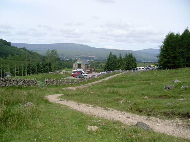 Looking down the mountain path to the Ben Nevis Inn | |
 Achintee Location within the Lochaber area | |
| OS grid reference | NN125730 |
| Council area |
|
| Country | Scotland |
| Sovereign state | United Kingdom |
| Postcode district | PH33 6 |
| Police | Scotland |
| Fire | Scottish |
| Ambulance | Scottish |
| UK Parliament |
|
| Scottish Parliament |
|
Achintee is the starting point for the "Mountain Path", the most popular route up Ben Nevis. The Ben Nevis Inn is within Achintee, at the end of a minor road.
The name Achintee is from the Gaelic for "the field of the seat".
References
- Ordnance Survey: Landranger map sheet 41 Ben Nevis (Fort William & Glen Coe) (Map). Ordnance Survey. 2013. ISBN 9780319229958.
This Highland location article is a stub. You can help Wikipedia by expanding it. |
Текст в блоке "Читать" взят с сайта "Википедия" и доступен по лицензии Creative Commons Attribution-ShareAlike; в отдельных случаях могут действовать дополнительные условия.
Другой контент может иметь иную лицензию. Перед использованием материалов сайта WikiSort.org внимательно изучите правила лицензирования конкретных элементов наполнения сайта.
Другой контент может иметь иную лицензию. Перед использованием материалов сайта WikiSort.org внимательно изучите правила лицензирования конкретных элементов наполнения сайта.
2019-2026
WikiSort.org - проект по пересортировке и дополнению контента Википедии
WikiSort.org - проект по пересортировке и дополнению контента Википедии