world.wikisort.org - Vereinigtes_Königreich
Wymondham ist eine historische Marktstadt und eine Civil parish im Distrikt South Norfolk der Grafschaft Norfolk.
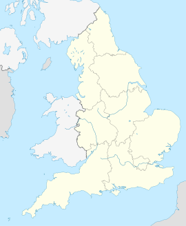
| Wymondham | |||
|---|---|---|---|
| Koordinaten | 52° 34′ N, 1° 7′ O | ||
| OS National Grid | TG1101 | ||
| |||
| Traditionelle Grafschaft | Norfolk | ||
| Einwohner | 12.539 (Stand: 2001) | ||
| Fläche | 44,31 km² (17,11 mi²) | ||
| Bevölkerungsdichte | 283 Ew./km² | ||
| Verwaltung | |||
| Post town | Wymondham | ||
| Vorwahl | 01953 | ||
| Landesteil | England | ||
| Shire county | Norfolk | ||
| Zeremonielle Grafschaft | Norfolk | ||
Sehenswürdigkeiten
- Wymondham Abbey
- Becket’s Chapel
- Market Cross
 Wymondham Abbey
 Becket’s Chapel
 Market Cross


Ehemalige und derzeitige Einwohner
- Francis Kett (um 1547–1589), anglikanischer Märtyrer
- Robert Ket († 1549), Anführer eines Bauernaufstandes
- John Wodehouse, 1. Earl of Kimberley (1826–1902)
- Simon Beaufoy (* 1966), Drehbuchautor
- Bill Bryson (* 1951), Schriftsteller
- Justin Hawkins (* 1975), Musiker
- James Hubbard (* 1992), Dartprofi
Weblinks
Commons: Wymondham – Sammlung von Bildern, Videos und Audiodateien
На других языках
- [de] Wymondham
[en] Wymondham
Wymondham (/ˈwɪndəm/ WIN-dəm) is a market town and civil parish in the South Norfolk district of Norfolk, England, 12 miles (19 km) south-west of Norwich off the A11 road to London. The River Tiffey runs through.[2] The parish, one of Norfolk's largest, includes rural areas to the north and south, with hamlets of Suton, Silfield, Spooner Row and Wattlefield.[3] It had a population of 14,405 in 2011,[1] of whom 13,587 lived in the town itself.[4]Текст в блоке "Читать" взят с сайта "Википедия" и доступен по лицензии Creative Commons Attribution-ShareAlike; в отдельных случаях могут действовать дополнительные условия.
Другой контент может иметь иную лицензию. Перед использованием материалов сайта WikiSort.org внимательно изучите правила лицензирования конкретных элементов наполнения сайта.
Другой контент может иметь иную лицензию. Перед использованием материалов сайта WikiSort.org внимательно изучите правила лицензирования конкретных элементов наполнения сайта.
2019-2026
WikiSort.org - проект по пересортировке и дополнению контента Википедии
WikiSort.org - проект по пересортировке и дополнению контента Википедии