world.wikisort.org - Vereinigtes_Königreich
Bishopbriggs (schottisch-gälisch Coille Dobhair) ist eine ehemalige Kleinstadt und heutiger Vorort von Glasgow in East Dunbartonshire. Der Ort verzeichnete im Jahre 2011 22.870 Einwohner.[1]
| Bishopbriggs | ||
|---|---|---|
 | ||
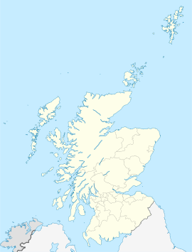
| Koordinaten | 55° 54′ N, 4° 13′ W | |
|
| ||
| Traditionelle Grafschaft | Lanarkshire | |
| Einwohner | 22.870 Zensus 2011 | |
| Verwaltung | ||
| Post town | GLASGOW | |
| Postleitzahlenabschnitt | G64 | |
| Vorwahl | 0141 | |
| Landesteil | Schottland | |
| Lieutenancy Area | Lanarkshire | |
| Council area | East Dunbartonshire | |
| Britisches Parlament | East Dunbartonshire | |
| Schottisches Parlament | Strathkelvin and Bearsden | |
Persönlichkeiten
- Jackie Henderson (1932–2005), Fußballspieler
- Jack Bruce (1943–2014), Musiker
- Steve Valentine (* 1966), Schauspieler
- Amy Macdonald (* 1987), Sängerin
- Marcus Fraser (* 1994), Fußballspieler
Einzelnachweise
Weblinks
Commons: Bishopbriggs – Sammlung von Bildern, Videos und Audiodateien
- Kirchen in Bishopbriggs
- Eintrag zu Bishopbriggs in Canmore, der Datenbank von Historic Environment Scotland (englisch).
На других языках
- [de] Bishopbriggs
[en] Bishopbriggs
Bishopbriggs (Scots: The Briggs; Scottish Gaelic: Achadh an Easbaig) is a town in East Dunbartonshire, Scotland. It lies on the northern fringe of Greater Glasgow, approximately 4 miles (6 km) from the city centre. Historically in Lanarkshire, the area was once part of the historic parish of Cadder - originally lands granted by King William the Lion to the Bishop of Glasgow, Jocelin, in 1180. It was later part of the county of Lanarkshire, and then an independent burgh from 1964 to 1975. Today, Bishopbriggs' close geographic proximity to Glasgow now effectively makes it a suburb and commuter town of the city. The town's original Gaelic name Coille Dobhair reflects the name of the old parish of Cadder, but modern Gaelic usage uses Drochaid an Easbaig, a literal translation of Bishopbriggs.[citation needed] It was ranked the 2nd most desirable postcode in Scotland to live in following a study by the Centre for Economic and Business Research in 2015 and 2016.[4][5][ru] Бишопбриггс
Бишопбри́ггс (англ. Bishopbriggs, гэльск. Coille Dobhair, скотс. Beeshops' Rigs ['biʃəps rɪgz][1]) — город в центральной Шотландии. Расположен в области Ист-Данбартоншир, в 9 км к юго-западу от окружного центра Керкинтиллох и в 5 км к северу от Глазго.Текст в блоке "Читать" взят с сайта "Википедия" и доступен по лицензии Creative Commons Attribution-ShareAlike; в отдельных случаях могут действовать дополнительные условия.
Другой контент может иметь иную лицензию. Перед использованием материалов сайта WikiSort.org внимательно изучите правила лицензирования конкретных элементов наполнения сайта.
Другой контент может иметь иную лицензию. Перед использованием материалов сайта WikiSort.org внимательно изучите правила лицензирования конкретных элементов наполнения сайта.
2019-2025
WikiSort.org - проект по пересортировке и дополнению контента Википедии
WikiSort.org - проект по пересортировке и дополнению контента Википедии
