world.wikisort.org - Vereinigtes_Königreich
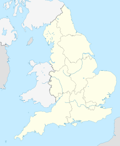
Buntingford ist eine Kleinstadt und ein Civil parish im Distrikt East Hertfordshire der englischen Grafschaft Hertfordshire. Sie ist die kleinste Stadt der Grafschaft und liegt am Fluss Rib.
| Buntingford | |||
|---|---|---|---|
 | |||
| Koordinaten | 51° 57′ N, 0° 1′ W | ||
| OS National Grid | TL363292 | ||
| |||
| Traditionelle Grafschaft | Hertfordshire | ||
| Einwohner | 4948 (Stand: 2011) | ||
| Verwaltung | |||
| Post town | Buntingford | ||
| Postleitzahlenabschnitt | SG9 | ||
| Vorwahl | 01763 | ||
| Landesteil | England | ||
| Region | East of England | ||
| Shire county | Hertfordshire | ||
| District | East Hertfordshire | ||
| Civil Parish | Buntingford | ||
| Britisches Parlament | North East Hertfordshire | ||
Östlich von Buntingford verläuft der Nullmeridian.
Städtepartnerschaften
Buntingford unterhält folgende Städtepartnerschaften:
 Luynes, Indre-et-Loire, Frankreich
 Ólvega, Soria, Spanien
Weblinks
- Buntingford Town Council (englisch)
На других языках
- [de] Buntingford
[en] Buntingford
Buntingford is a market town and civil parish in the district of East Hertfordshire and county of Hertfordshire in England. It lies next to the River Rib and is located on the historic Roman road, Ermine Street. As a result of its location, it grew mainly as a staging post with many coaching inns and has an 18th-century one-cell prison known as The Cage, by the ford at the end of Church Street. It has a population of 6,844, as of the 2020 UK Census.Текст в блоке "Читать" взят с сайта "Википедия" и доступен по лицензии Creative Commons Attribution-ShareAlike; в отдельных случаях могут действовать дополнительные условия.
Другой контент может иметь иную лицензию. Перед использованием материалов сайта WikiSort.org внимательно изучите правила лицензирования конкретных элементов наполнения сайта.
Другой контент может иметь иную лицензию. Перед использованием материалов сайта WikiSort.org внимательно изучите правила лицензирования конкретных элементов наполнения сайта.
2019-2025
WikiSort.org - проект по пересортировке и дополнению контента Википедии
WikiSort.org - проект по пересортировке и дополнению контента Википедии