world.wikisort.org - Ukraine
Znamenka (Ukrainian: Зна́м'янка) is a town in Kropyvnytskyi Raion, Kirovohrad Oblast (province) of Ukraine. It hosts the administration of Znamianka urban hromada, one of the hromadas of Ukraine.[1] Population: 21,479 (2021 est.)[2].
Znamianka
Зна́м'янка | |
|---|---|
City of regional significance | |
 Znamjanka City Hall | |
 Flag  Coat of arms | |
 Znamianka  Znamianka | |
| Coordinates: 48°42′49″N 32°40′24″E | |
| Country | Ukraine |
| Oblast | Kirovohrad Oblast |
| Raion | Kropyvnytskyi Raion |
| Founded | 1869 |
| Area | |
| • Total | 14.8 km2 (5.7 sq mi) |
| Population (2021) | |
| • Total | 21,479 |
| • Density | 1,500/km2 (3,800/sq mi) |
| Postal code | 27400 |
| Area code(s) | +380 5233 |
It is located about half way between the regional center Kropyvnytskyi (west), and cities of Oleksandriia (east) and Svitlovodsk (north).
History
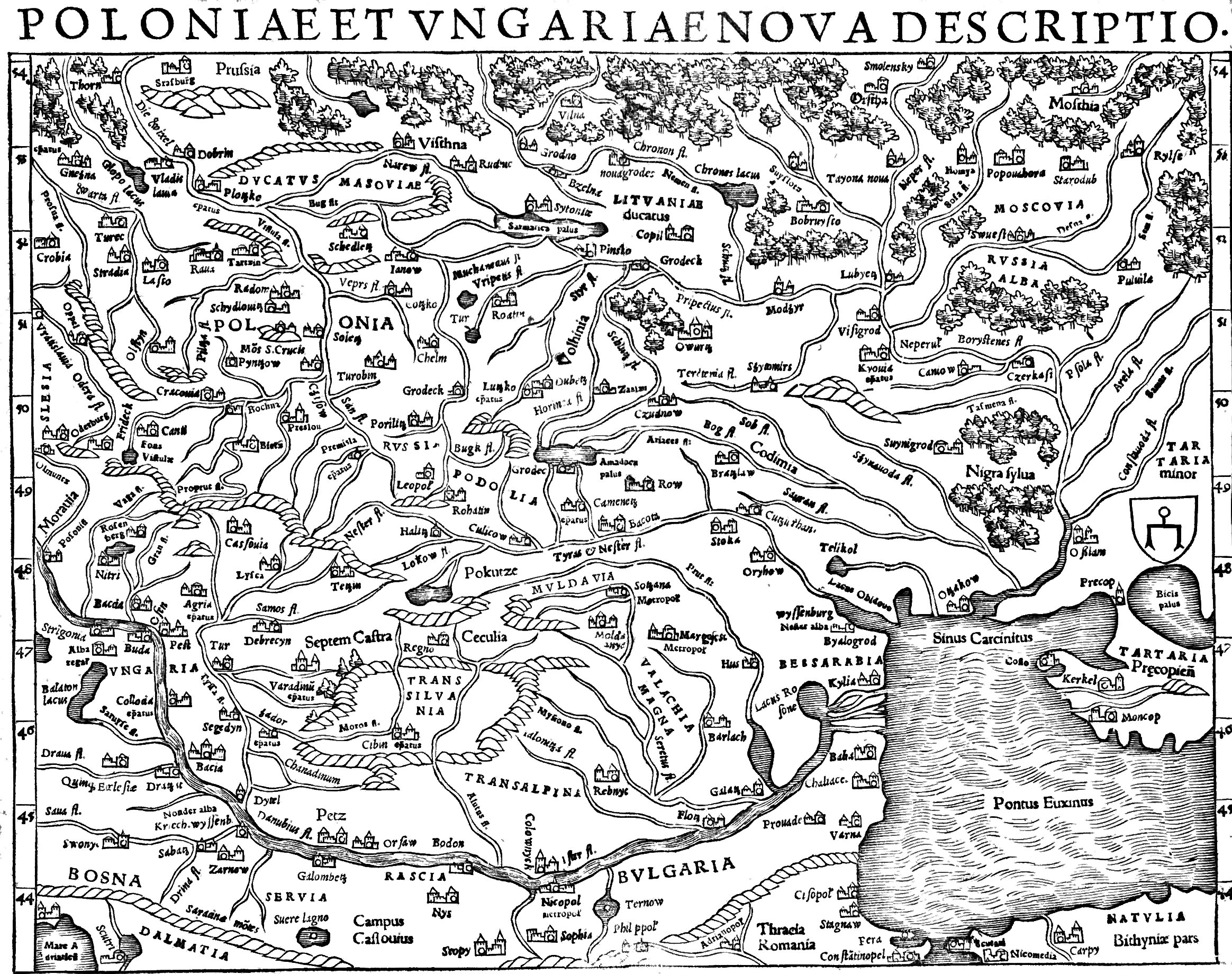

Znamianka was established in 1869 when there started train movement between Kharkiv and Odessa in area that historically was known as Black Forest (or Nigra Sylva).[3] At the meadow of Black Forest, through which stretched a segment of Yelizavetgrad – Kriukov (west–east), there was built the train station main building and its offices.[3] The station was named after the original village Znamianka that was located 3 km (1.9 mi) away[3] and today is known as Znamianka Druha.
To the area were resettled peasants from the Oryol Governorate area, possible the Russian Old Believers for whom the Our Lady of the Sign sacred. In Russian the Sign means Znamiennie, so in diminutive form the settlement's name became Znamianka.
In 1873 there was opened movement of trains on the segment Znamianka – Mykolaiv, in 1876 towards Fastiv.[3] Out of a small train station Znamianka started to transform into a rail hub.[3] Znamianka became a train station at four-way crossroads northeast towards Kremenchuk, south towards Mykolaiv, west towards Balta and northwest towards Fastiv.
Simultaneously with building of the train station on a land lot that was rent out from landowners Osipovs by people from neighboring villages and other counties (uyezds), there appeared a small settlement of railway workers, Osipovoye.[3] In 1886 there already were 24 private houses, an earth shelter, six trading places and population of 143.[3] Couple of dozens years later just south of the train station there appeared another settlement of Linitskoye.[3] In 1913 in both Osipovoye and Linitskoye lived about 6,000 people.[3]
In the beginning for sometime the train station was classified of the third category with its locomotive depot accounting for 4 locomotives.[3] In December 1883 when there ended construction of the new train station building, there were 29 locomotives and the depot employed some 92 workers.[3] In the 1890s the rail hub was shipping out some 580,000 poods of bread annually.[3]
During the 1917 to 1921 Ukrainian War of Independence Znamianka was part of the Kholodny Yar Republic.[4]
During World War II Znamianka was under German occupation from August 5, 1941 to December 9, 1943.
In January 1989 the population was 33 828 people.[5]
In 2012, based on the law "On the principles of the State language policy", City Council declared Znamianka's regional language to be Russian.[4] On 28 February 2018 the Constitutional Court of Ukraine ruled this law unconstitutional.[6]
In January 2013 the population was 23 983 people.[7]
There is a memorial to the soldiers of the 5th Guards Tank Army, who liberated the town from the Germans.[8] It takes the form of a tank mounted on a plinth.
Until 18 July 2020, Znamianka was designated as a city of oblast significance and belonged to Znamianka Municipality but not to Znamianka Raion even though it was the center of the raion. Znamianka Municipality combined the city of Znamianka, the urban-tye settlement of Znamianka Druha, and the village of Vodyane. As part of the administrative reform of Ukraine, which reduced the number of raions of Kirovohrad Oblast to four, Znamianka Municipality was merged into Kropyvnytskyi Raion.[9][10]
Climate
| Climate data for Znamianka (1981–2010) | |||||||||||||
|---|---|---|---|---|---|---|---|---|---|---|---|---|---|
| Month | Jan | Feb | Mar | Apr | May | Jun | Jul | Aug | Sep | Oct | Nov | Dec | Year |
| Average high °C (°F) | −1.4 (29.5) |
−0.5 (31.1) |
5.0 (41.0) |
14.5 (58.1) |
21.3 (70.3) |
24.5 (76.1) |
26.9 (80.4) |
26.6 (79.9) |
20.5 (68.9) |
13.1 (55.6) |
4.7 (40.5) |
−0.1 (31.8) |
12.9 (55.2) |
| Daily mean °C (°F) | −4.0 (24.8) |
−3.6 (25.5) |
1.3 (34.3) |
9.0 (48.2) |
15.2 (59.4) |
18.6 (65.5) |
20.8 (69.4) |
20.1 (68.2) |
14.5 (58.1) |
8.2 (46.8) |
1.7 (35.1) |
−2.6 (27.3) |
8.3 (46.9) |
| Average low °C (°F) | −6.7 (19.9) |
−6.5 (20.3) |
−2.1 (28.2) |
4.1 (39.4) |
9.3 (48.7) |
13.3 (55.9) |
15.2 (59.4) |
14.3 (57.7) |
9.5 (49.1) |
4.2 (39.6) |
−1.0 (30.2) |
−5.1 (22.8) |
4.0 (39.2) |
| Average precipitation mm (inches) | 35.8 (1.41) |
34.0 (1.34) |
34.3 (1.35) |
36.9 (1.45) |
50.3 (1.98) |
81.6 (3.21) |
72.1 (2.84) |
53.0 (2.09) |
57.9 (2.28) |
42.0 (1.65) |
41.7 (1.64) |
36.8 (1.45) |
576.4 (22.69) |
| Average precipitation days (≥ 1.0 mm) | 7.3 | 7.1 | 7.7 | 6.9 | 7.1 | 8.9 | 7.1 | 5.5 | 6.3 | 5.4 | 7.1 | 7.2 | 83.6 |
| Average relative humidity (%) | 86.6 | 83.7 | 79.0 | 68.3 | 64.5 | 69.4 | 68.3 | 65.6 | 72.6 | 79.7 | 87.4 | 88.3 | 76.1 |
| Mean monthly sunshine hours | 52.9 | 76.5 | 134.2 | 186.3 | 283.8 | 289.5 | 312.9 | 294.0 | 211.1 | 141.4 | 57.7 | 44.0 | 2,084.3 |
| Source: World Meteorological Organization[11] | |||||||||||||
Gallery
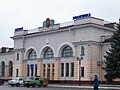 Znamianka railway station
 Historical train next to railway station
 Platform of railway station
 Downtown Znamianka
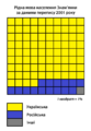 Native language by the 2001 census (Ukrainian in yellow)
 Rail yard in Znamianka


References
| Wikimedia Commons has media related to Znamianka. |
- "Знаменская городская громада" (in Russian). Портал об'єднаних громад України.
- Чисельність наявного населення України на 1 січня 2021 / Number of Present Population of Ukraine, as of January 1, 2021 (PDF) (in Ukrainian and English). Kyiv: State Statistics Service of Ukraine.
- (Знам’янка, Знам’янський район, Кіровоградська область). The History of Cities and Villages of the Ukrainian SSR (ukrssr.com.ua).
- (in Ukrainian) Without favorites and self-nominated. Who claims to win the "hot spot" of the elections in Kirovograd region, The Ukrainian Week (14 October 2020)
- Всесоюзная перепись населения 1989 г. Численность городского населения союзных республик, их территориальных единиц, городских поселений и городских районов по полу
- "Constitutional Court declares unconstitutional language law of Kivalov-Kolesnichenko". Ukrinform. 28 February 2018. Retrieved 2019-05-04.
- Чисельність наявного населення України на 1 січня 2013 року. Державна служба статистики України. Київ, 2013. стор.70
- "Шукач - dombrovskii_a посетил(а) "5-я гвардейская танковая армия. Памятник освободителям Знаменки."". Shukach.com. Retrieved 26 July 2018.
- "Про утворення та ліквідацію районів. Постанова Верховної Ради України № 807-ІХ". Голос України (in Ukrainian). 2020-07-18. Retrieved 2020-10-03.
- "Нові райони: карти + склад" (in Ukrainian). Міністерство розвитку громад та територій України.
- "World Meteorological Organization Climate Normals for 1981–2010". World Meteorological Organization. Archived from the original on 17 July 2021. Retrieved 17 July 2021.
External links
- Volodymyr Panchenko. In the arms of the Black Forest (В обіймах Чорного лісу). The Ukrainian Week. 29 October 2017
Administrative center: Kropyvnytskyi | ||
| Raions |
| |
| Hromadas |
| |
| Cities |
| |
| Urban-type settlements | ||
Authority control | |
|---|---|
| National libraries | |
| Other | |
На других языках
- [en] Znamianka, Kirovohrad Oblast
[ru] Знаменка (город)
Зна́менка (укр. Знам'янка) — город в Кировоградской области Украины. Входит в Кропивницкий район.Другой контент может иметь иную лицензию. Перед использованием материалов сайта WikiSort.org внимательно изучите правила лицензирования конкретных элементов наполнения сайта.
WikiSort.org - проект по пересортировке и дополнению контента Википедии