world.wikisort.org - Ukraine
Shyroke (Ukrainian: Широке; Russian: Широкое) is a settlement (posyolok) in Bashtanka Raion (district) in Mykolaiv Oblast of southern Ukraine, at about 54.9 kilometres (34.1 mi) east-northeast from the centre of Mykolaiv city. It hosts the administration of Shyroke rural hromada, one of the hromadas of Ukraine.[2]
Shyroke
Широке | |
|---|---|
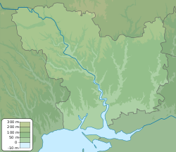 Shyroke Location of Shyroke within Ukraine  Shyroke Shyroke (Ukraine) | |
| Coordinates: 47.098611°N 32.671389°E | |
| Country | |
| Oblast | Mykolaiv Oblast |
| Raion | Bashtanka Raion |
| Founded | 1947 |
| Area | |
| • Total | 0.06 km2 (0.02 sq mi) |
| Elevation | 58 m (190 ft) |
| Population (2001 census)[1] | |
| • Total | 779 |
| • Density | 13,000/km2 (34,000/sq mi) |
| Time zone | UTC+2 (EET) |
| • Summer (DST) | UTC+3 (EEST) |
| Postal code | 57324 |
| Area code | +380 5162 |
 | |
Until 18 July 2020, Shyroke belonged to Snihurivka Raion. The raion was abolished that day as part of the administrative reform of Ukraine, which reduced the number of raions of Mykolaiv Oblast to four. The area of Snihurivka Raion was merged into Bashtanka Raion.[3][4]
The settlement came under attack by Russian forces in 2022, during the Russian invasion of Ukraine.[5]
References
- "Distribution of the population by native language on ukrcensus.gov.ua". Archived from the original on 31 July 2014. Retrieved 26 September 2022.
- "Широковская громада" (in Russian). Портал об'єднаних громад України.
- "Про утворення та ліквідацію районів. Постанова Верховної Ради України № 807-ІХ". Голос України (in Ukrainian). 18 July 2020. Retrieved 3 October 2020.
- "Нові райони: карти + склад" (in Ukrainian). Міністерство розвитку громад та територій України.
- Clark, Mason; Stepanenko, Kateryna; Barros, George (27 April 2022). "Russian Offensive Campaign Assessment, April 27". Institute for the Study of War. Retrieved 28 April 2022.
Local fighting continued in the Mykolayiv direction, with Russian forces conducting failed attacks towards Tavriyske and Nova Zorya and Ukrainian forces reportedly recapturing Shyroke, Novopetrivka, and Lyubino, 50 km north of Kherson.
На других языках
- [en] Shyroke, Mykolaiv Oblast
[ru] Широкое (Николаевская область)
Широкое (укр. Широке) — посёлок в Снигирёвском районе Николаевской области Украины.Текст в блоке "Читать" взят с сайта "Википедия" и доступен по лицензии Creative Commons Attribution-ShareAlike; в отдельных случаях могут действовать дополнительные условия.
Другой контент может иметь иную лицензию. Перед использованием материалов сайта WikiSort.org внимательно изучите правила лицензирования конкретных элементов наполнения сайта.
Другой контент может иметь иную лицензию. Перед использованием материалов сайта WikiSort.org внимательно изучите правила лицензирования конкретных элементов наполнения сайта.
2019-2025
WikiSort.org - проект по пересортировке и дополнению контента Википедии
WikiSort.org - проект по пересортировке и дополнению контента Википедии