world.wikisort.org - Ukraine
Liuta, also Ljuta (Ukrainian: Люта; Hungarian: Havasköz) is a small village located in the Uzhhorod Raion of Zakarpattia Oblast of Ukraine.
Liuta
Люта Havasköz | |
|---|---|
 Coat of arms | |
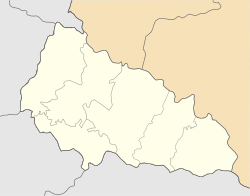 Liuta Location of Liuta in Zakarpattia Oblast  Liuta Location of Liuta in Ukraine | |
| Coordinates: 48°54′0″N 22°46′0″E | |
| Country | |
| Oblast | |
| Raion | Uzhhorod Raion |
| Elevation | 540 m (1,770 ft) |
| Population | |
| • Total | 2,412 |
| Time zone | UTC+2 (EET) |
| • Summer (DST) | UTC+3 (EET) |
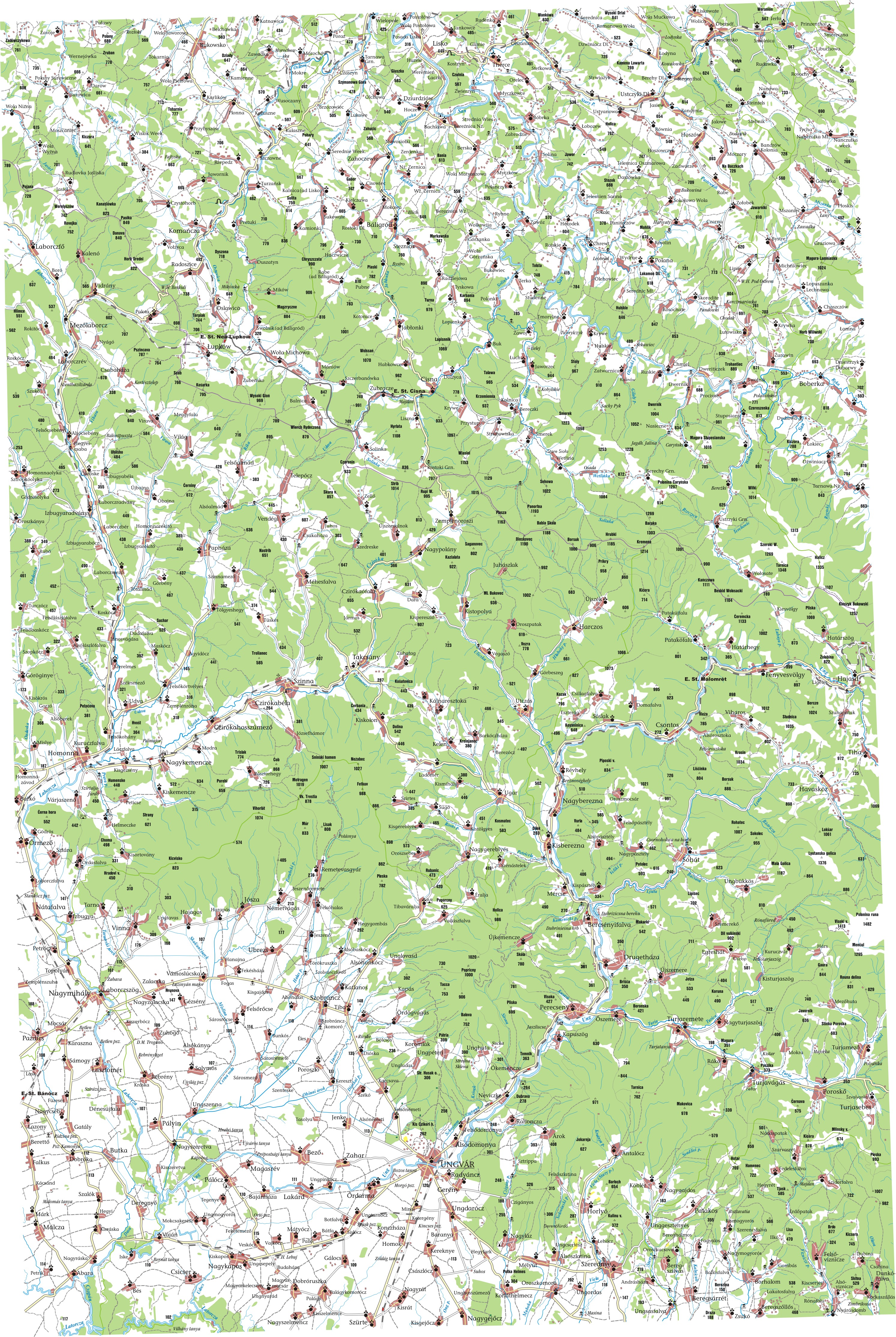
Lyuta lies at the foot of the Carpathian Mountains, about 25 miles (40 km) northeast of Uzhhorod and 362 miles (583 km) West-SouthWest of Kyiv. It is on the bank of the Liutianka River. The name of the village means snowyside/snowycorner because of the cold winters in the area. Its history dates back to 1599. The estimated population is under 4000 people.
Until 18 July 2020, Liuta belonged to Velykyi Bereznyi Raion. The raion was abolished in July 2020 as part of the administrative reform of Ukraine, which reduced the number of raions of Zakarpattia Oblast to six. The area of Velykyi Bereznyi Raion was merged into Uzhhorod Raion.[1][2]
See also
- Carpathian Ruthenia
- Carpatho-Ukraine
- Rusyns
References
- "Про утворення та ліквідацію районів. Постанова Верховної Ради України № 807-ІХ". Голос України (in Ukrainian). 2020-07-18. Retrieved 2020-10-03.
- "Нові райони: карти + склад" (in Ukrainian). Міністерство розвитку громад та територій України.
External links
- MultiMap (Current) http://uk2.multimap.com/M4/browse.cgi?scale=100000&lon=22.7667&lat=48.9000&icon=X%5B%5D
- Detailed map (1910 Ung) http://lazarus.elte.hu/hun/tantort/2003/palyazat/40-49_ungvar.jpg
- Further information http://www.fallingrain.com/world/UP/0/Lyuta.html
Administrative center: Uzhhorod | ||
| Raions | ||
| Hromadas | ||
| Cities |
| |
| Urban-type settlements |
| |
| Authority control: National libraries |
|---|
This article about a location in Zakarpattia Oblast is a stub. You can help Wikipedia by expanding it. |
На других языках
- [en] Liuta
[ru] Люта (Закарпатская область)
Люта (венг. Havasköz, укр. Люта) — село в Костринской сельской общине Ужгородского района Закарпатской области Украины.Другой контент может иметь иную лицензию. Перед использованием материалов сайта WikiSort.org внимательно изучите правила лицензирования конкретных элементов наполнения сайта.
WikiSort.org - проект по пересортировке и дополнению контента Википедии