world.wikisort.org - Ukraine
Kyrylivka (Ukrainian: Кирилівка, pronounced [kɪˈrɪl⁽ʲ⁾iu̯kɐ]) is an urban-type settlement in the Melitopol Raion of Zaporizhzhia Oblast[2] in southern Ukraine. Administrative centre of Kyrylivka Hromada, which includes 7 more villages. Population: 3,420 (2021 est.)[3]. The town is located on the northern coast of the Sea of Azov and surrounded by both Utliuk Lyman and Molochnyi Lyman. Some of its areas are part of Pryazovskyi National Nature Park.
Kyrylivka
Кирилівка | |
|---|---|
Urban-type settlement | |
 | |
 Flag  Coat of arms | |
 Kyrylivka Location of Kyrylivka in Zaporizhzhia Oblast 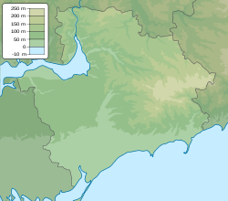 Kyrylivka Kyrylivka (Zaporizhzhia Oblast) | |
| Coordinates: 46°22′12″N 35°22′0″E | |
| Country | |
| Province | Zaporizhzhia Oblast |
| District | Melitopol Raion |
| Founded | 1805 |
| Settlement status | 1967 |
| Area | |
| • Total | 1,654 km2 (639 sq mi) |
| Elevation | 10 m (30 ft) |
| Population (2021) | |
| • Total | |
| Time zone | UTC+2 (EET) |
| • Summer (DST) | UTC+3 (EEST) |
| Postal code | 72563 |
| Area code | +380 6131 |
| Website | krlk.gov.ua |
 | |
History
The area was settled by Doukhobors in 1805. Kyrylo Kapustin became the first inhabitant and the village was named after him.[4]
In 1838 the population of Kyrylivka increased to 130 people. After some time, local Doukhobors were sent to the Caucasus, except those who would return to Russian Orthodox Church.
In 1926 sanatorium "Kyrylivka" was founded after the mud bath clinic opened. From there on, Kyrylivka began to develop as a resort destination.[5]
In 1968 the village received an urban-type settlement status.
In 2001 its population was 1,481 according to the census.
During the 2022 Russian invasion of Ukraine, Kyrylivka was occupied by Russian forces after the capture of Melitopol.[6]
Gallery


References
- "Kyrylivka (Zaporizhzhia Oblast, Yakymivka Raion)". weather.in.ua. Retrieved 18 June 2019.
- "Кирилівська селищна (сільська) рада". rada.info (in Ukrainian). Retrieved 18 June 2019.
- Чисельність наявного населення України на 1 січня 2021 [Number of Present Population of Ukraine, as of January 1, 2021] (PDF) (in Ukrainian and English). Kyiv: State Statistics Service of Ukraine.
- "Guidebook Kyrylivka (in ukrainian)".
- "ЗАСНОВНИКИ ТА ВИЗНАЧНІ ДІЯЧІ КУРОРТІВ УКРАЇНИ" (PDF).
- "The occupiers arrived in the resort of Kyrylivka, authorities refused to "cooperate"".
External links
- krlk.gov.ua – Official website of Kyrylivka
На других языках
[de] Kyryliwka
Kyryliwka (ukrainisch Кирилівка; russisch Кирилловка .mw-parser-output .Latn{font-family:"Akzidenz Grotesk","Arial","Avant Garde Gothic","Calibri","Futura","Geneva","Gill Sans","Helvetica","Lucida Grande","Lucida Sans Unicode","Lucida Grande","Stone Sans","Tahoma","Trebuchet","Univers","Verdana"}Kirillowka) ist eine Siedlung städtischen Typs im Süden der ukrainischen Oblast Saporischschja mit etwa 3400 Einwohnern (2018).[1]- [en] Kyrylivka
[ru] Кирилловка (Запорожская область)
Кири́лловка (укр. Кирилівка) — посёлок городского типа в Мелитопольском районе Запорожской области, курорт на северо-западном побережье Азовского моря.Другой контент может иметь иную лицензию. Перед использованием материалов сайта WikiSort.org внимательно изучите правила лицензирования конкретных элементов наполнения сайта.
WikiSort.org - проект по пересортировке и дополнению контента Википедии