world.wikisort.org - Turquie
Şereflikoçhisar est une ville et district de la province d'Ankara en Turquie.
| Şereflikoçhisar | |||
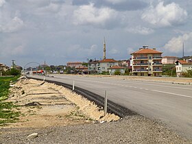
 Entrée de Şereflikoçhisar. | |||
| Administration | |||
|---|---|---|---|
| Pays | |||
| Région | Région de l'Anatolie centrale | ||
| Province | Ankara | ||
| Indicatif téléphonique international | +(90) | ||
| Plaque minéralogique | 06 | ||
| Géographie | |||
| Coordonnées | 38° 56′ 40″ nord, 33° 32′ 31″ est | ||
| Superficie | 159 100 ha = 1 591 km2 | ||
| Localisation | |||
 Districts de la province d'Ankara | |||
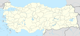
| Géolocalisation sur la carte : Turquie
Géolocalisation sur la carte : Turquie
| |||
| modifier |
|||
La ville de Şereflikoçhisar se situe à 150 km d'Ankara. Première grande ville au nord du Lac Salé, elle est plus proche de Aksaray et Konya. Elle s'étend dans ce qui furent les confins occidentaux de l'antique royaume de Cappadoce face à la Galatie et la Lycaonie. Son nom signifie en turc « château (hisar) des honorables (şerefli) béliers (koç) ».
Sa superficie est de 1 591 km2 et elle comptait 59 128 habitants au recensement de 2000, dont 42 083 à Şereflikoçhisar et 17 045 dans les villages.
Le climat est continental, très rigoureux en hiver, et la température peut descendre jusqu'à -21 °C[1].
Notes et références
- (en) M. J. A. Werger et Marja A van Staalduinen (dir.), Eurasian Steppes. Ecological Problems and Livelihoods in a Changing World, vol. 6 de Plant and vegetation, Springer, 2012, p. 152 (ISBN 9789400738867)
Voir aussi
Bibliographie
- (tr) İbrahim Hakkı Konyalı, Âbideleri ve kitabeleri ile Şereflikoçhisar tarihi [yazan], Fatih Matbaası, Istanbul, 1971, 696 p.
Liens externes
- (tr) Şereflikoçhisar Kaymakamlığı (site du district)
- (tr) Şereflikoçhisar Belediyesi (site de la municipalité)
- Portail de la Turquie
На других языках
[de] Şereflikoçhisar
Vorlage:Infobox Ort in der Türkei/Wartung/EinwohnerOrtFehlt[en] Şereflikoçhisar
Şereflikoçhisar is a town and district of Ankara Province in the Central Anatolia region of Turkey, 148 km south of the city of Ankara. According to 2010 census, population of the district is 35898 of which 29,091 live in the town of Şereflikoçhisar and the remainder in surrounding villages.[2][3] The district covers an area of 2,034 km², and the average elevation varies between 900 and 1,200 m, with the highest point being Mt. Karasenir at 1,650 m.- [fr] Şereflikoçhisar
Текст в блоке "Читать" взят с сайта "Википедия" и доступен по лицензии Creative Commons Attribution-ShareAlike; в отдельных случаях могут действовать дополнительные условия.
Другой контент может иметь иную лицензию. Перед использованием материалов сайта WikiSort.org внимательно изучите правила лицензирования конкретных элементов наполнения сайта.
Другой контент может иметь иную лицензию. Перед использованием материалов сайта WikiSort.org внимательно изучите правила лицензирования конкретных элементов наполнения сайта.
2019-2025
WikiSort.org - проект по пересортировке и дополнению контента Википедии
WikiSort.org - проект по пересортировке и дополнению контента Википедии

