world.wikisort.org - Thailand
Thai Ban (Thai: ท้ายบ้าน, pronounced [tʰáːj bâːn]) is a tambon (sub-district) in Mueang Samut Prakan District, Samut Prakan Province.
This article needs additional citations for verification. (September 2022) |
Thai Ban
ท้ายบ้าน | |
|---|---|
Tambon | |
 Wat Asokaram a renowned local Buddhist temple | |
| Etymology: "the end of the village" | |
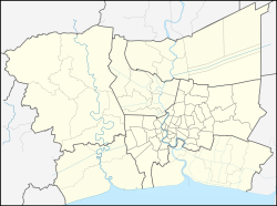 Thai Ban Location in Bangkok Metropolitan Region | |
| Coordinates: 13°33′10.4″N 100°35′20.0″E | |
| Country | Thailand |
| Province | Samut Prakan |
| District | Mueang Samut Prakan |
| Population (April 30, 2022) | 24,350[1] |
| Time zone | UTC+7 (ICT) |
| Postcode | 10280 |
| Area code | (+66) 02 |
Toponymy
Its name "Thai Ban" literally translates to "the end of the muban (village)". Because during the reign of King Chulalongkorn (Rama V), it was considered a very distant area from the downtown Samut Prakan, also colloquially known as Pak Nam. At that time it was called "Thai Ban Talat" (the end of the marketplace), later called "Thai Ban" for short.[2]
Geography
Adjacent areas are, clockwise from north, Pak Nam, Thai Ban Mai, Bang Pu Mai, all of them are in its district, and Laem Fa Pha in Phra Samut Chedi District (across Chao Phraya River). It borders Bay of Bangkok (upper Gulf of Thailand) to the south.[3]
Administration
Central administration
The entire area is under the administration of Bang Pu Sub-District Municipality.
Local administration
Thai Ban is divided into seven administrative villages.
Population
As of April 30, 2022, it had a total population of 24,350 people (11,866 males, 12,484 females) in 11,415 households.[1]
Places
- Wat Asokaram
- Wat Rat Pho Thong
- Wat Thong Kong
- Hadamara Aksornlak Wittaya School
- Taurak Kindergarten
- Thai Ban Health Promoting Hospital
- Ammara Beach Roundabout
Neighbouring places
- Bang Pu Recreation Center
- Bangpoo Industrial Estate
- Kheha BTS Station (E23)
References
- "หน้าหลัก" [Main page]. Bangpoocity (in Thai).
- pongsakornlovic (2011-06-14). "CHN_354_วงเวียนท้ายบ้าน" [CHN_354_Thai Ban Circle]. YouTube (in Thai). Retrieved 2022-06-21.
- "อำเภอเมืองสมุทรปราการ จังหวัดสมุทรปราการ" [Map of Mueang Samut Prakan District, Samut Prakan Province]. R01.ldd.go.th (in Thai).
Другой контент может иметь иную лицензию. Перед использованием материалов сайта WikiSort.org внимательно изучите правила лицензирования конкретных элементов наполнения сайта.
WikiSort.org - проект по пересортировке и дополнению контента Википедии