world.wikisort.org - Thailand
Benchalak (Thai: เบญจลักษ์, pronounced [bēn.t͡ɕā.lák]) is a district (amphoe) of Sisaket province, northeastern Thailand.
Benchalak
เบญจลักษ์ | |
|---|---|
District | |
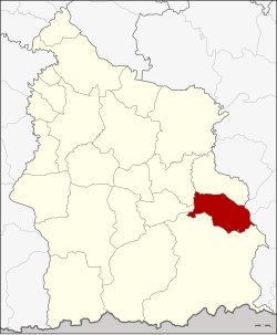 District location in Sisaket province | |
| Coordinates: 14°47′42″N 104°40′12″E | |
| Country | Thailand |
| Province | Sisaket |
| Seat | Siao |
| Area | |
| • Total | 331.3 km2 (127.9 sq mi) |
| Population (2005) | |
| • Total | 35,807 |
| • Density | 108.1/km2 (280/sq mi) |
| Time zone | UTC+7 (ICT) |
| Postal code | 33110 |
| Geocode | 3319 |
History
The minor district (king amphoe) was created on 31 May 1993, when five tambons were split off from Kantharalak district.[1] It was upgraded to a full district on 5 December 1996.[2]
Geography
Neighboring districts are (from the south clockwise): Kantharalak, Si Rattana, Nam Kliang, and Non Khun of Sisaket Province; Det Udom and Thung Si Udom of Ubon Ratchathani province.
Administration
The district is divided into five sub-districts (tambons), which are further subdivided into 64 villages (mubans). There are no municipal (thesaban) areas. There are five tambon administrative organizations (TAO).
| No. | Name | Thai name | Villages | Pop. | |
|---|---|---|---|---|---|
| 1. | Siao | เสียว | 14 | 7,469 | |
| 2. | Nong Wa | หนองหว้า | 15 | 7,395 | |
| 3. | Nong Ngu Lueam | หนองงูเหลือม | 12 | 7,059 | |
| 4. | Nong Hang | หนองฮาง | 12 | 6,739 | |
| 5. | Tha Khlo | ท่าคล้อ | 11 | 7,145 |
References
- ประกาศกระทรวงมหาดไทย เรื่อง แบ่งเขตท้องที่อำเภอกันทรลักษ์ จังหวัดศรีสะเกษ ตั้งเป็นกิ่งอำเภอเบญจลักษ์ (PDF). Royal Gazette (in Thai). 110 (74 ง): 18. 8 June 1993.
- พระราชกฤษฎีกาตั้งอำเภอเหนือคลอง อำเภอนายายอาม อำเภอท่าตะเกียบ อำเภอขุนตาล อำเภอแม่ฟ้าหลวง อำเภอแม่ลาว อำเภอรัษฎา อำเภอพุทธมณฑล อำเภอวังน้ำเขียว อำเภอเจาะไอร้อง อำเภอชำนิ อำเภอโนนดินแดง อำเภอปางมะผ้า อำเภอสนธิ อำเภอหนองม่วง อำเภอเบญจลักษ์ อำเภอโพนนาแก้ว อำเภอบุ่งคล้า อำเภอดอนมดแดง และอำเภอลืออำนาจ พ.ศ. ๒๕๓๙ (PDF). Royal Gazette (in Thai). 113 (62 ก): 5–8. 20 November 1996.
External links
Sisaket Province | ||
|---|---|---|
Sisaket (capital) | ||
| Districts (amphoe) |
|  |
| Related topics |
| |
| Neighboring areas |
| |
This Sisaket Province location article is a stub. You can help Wikipedia by expanding it. |
Другой контент может иметь иную лицензию. Перед использованием материалов сайта WikiSort.org внимательно изучите правила лицензирования конкретных элементов наполнения сайта.
WikiSort.org - проект по пересортировке и дополнению контента Википедии