world.wikisort.org - Syria
as-Suwayda District (Arabic: منطقة السويداء, romanized: manṭiqat as-Suwaydā’) is a district of the as-Suwayda Governorate in southern Syria. The administrative centre is the city of as-Suwayda. At the 2004 census, the district had a population of 180,907.[1]
as-Suwayda District
منطقة السويداء | |
|---|---|
District | |
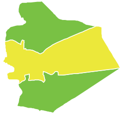 Map of as-Suwayda District within as-Suwayda Governorate | |
| Coordinates (as-Suwayda): 32.7°N 36.57°E | |
| Country | |
| Governorate | as-Suwayda |
| Seat | as-Suwayda |
| Subdistricts | 3 nawāḥī |
| Area | |
| • Total | 2,804.22 km2 (1,082.72 sq mi) |
| Population (2004)[1] | |
| • Total | 180,907 |
| • Density | 65/km2 (170/sq mi) |
| Geocode | SY1300 |
Sub-districts
The district of as-Suwayda is divided into three sub-districts or nawāḥī (population as of 2004[1]):
| Code | Name | Area | Population |
|---|---|---|---|
| SY130000 | as-Suwayda Subdistrict | 691.13 km2 | 212,463 |
| SY130001 | al-Mazraa Subdistrict | 202.53 km2 | 16,627 |
| SY130002 | al-Mushannaf Subdistrict | 1,910.57 km2 | 17,134 |
See also
- List of populated places in as-Suwayda Governorate
References
- "General Census of Population and Housing 2004" (PDF) (in Arabic). Syrian Central Bureau of Statistics. Archived from the original (PDF) on 8 December 2015. Retrieved 15 October 2015. Also available in English: "2004 Census Data". UN OCHA. Retrieved 15 October 2015.
| |||||||||||||||
| |||||||||||||||
| |||||||||||||||
This article about a location in as-Suwayda Governorate, Syria is a stub. You can help Wikipedia by expanding it. |
На других языках
- [en] As-Suwayda District
[ru] Эс-Сувейда (район)
Эс-Сувейда (араб. السويداء) — район (минтака) в составе мухафазы Эс-Сувейда, Сирия. Административным центром является город Эс-Сувейда.Текст в блоке "Читать" взят с сайта "Википедия" и доступен по лицензии Creative Commons Attribution-ShareAlike; в отдельных случаях могут действовать дополнительные условия.
Другой контент может иметь иную лицензию. Перед использованием материалов сайта WikiSort.org внимательно изучите правила лицензирования конкретных элементов наполнения сайта.
Другой контент может иметь иную лицензию. Перед использованием материалов сайта WikiSort.org внимательно изучите правила лицензирования конкретных элементов наполнения сайта.
2019-2026
WikiSort.org - проект по пересортировке и дополнению контента Википедии
WikiSort.org - проект по пересортировке и дополнению контента Википедии