world.wikisort.org - Spagna
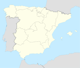
Gisclareny è un comune spagnolo di 28 abitanti situato nella comunità autonoma della Catalogna.
| Gisclareny comune | |||
|---|---|---|---|
| |||
 | |||
| Localizzazione | |||
| Stato | |||
| Comunità autonoma | |||
| Provincia | |||
| Territorio | |||
| Coordinate | 42°15′07″N 1°47′15″E | ||
| Altitudine | 1 340 m s.l.m. | ||
| Superficie | 36,5 km² | ||
| Abitanti | 28 (2001) | ||
| Densità | 0,77 ab./km² | ||
| Comuni confinanti | Bagà, Bellver de Cerdanya (L), Guardiola de Berguedà, Montellà i Martinet (L), Saldes, Vallcebre | ||
| Altre informazioni | |||
| Cod. postale | 08695 | ||
| Fuso orario | UTC+1 | ||
| Codice INE | 08093 | ||
| Targa | B | ||
| Comarca | Berguedà | ||
| Cartografia | |||
 Gisclareny | |||
| Sito istituzionale | |||
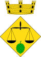

Stemma
Escut caironat: d'or, una balança de sable acompanyada a la punta d'una pinya de sinople. Per timbre una corona mural de poble.
Altri progetti
 Wikimedia Commons contiene immagini o altri file su Gisclareny
Collegamenti esterni
- Sito ufficiale, su gisclareny.cat.
| Controllo di autorità | VIAF (EN) 145588965 · LCCN (EN) n97001020 |
|---|
На других языках
[en] Gisclareny
Gisclareny is a municipality in the comarca of Berguedà, Catalonia, located in Cadí-Moixeró Natural Park. 2018 it again became the smallest village in Catalonia after the village of Sant Jaume de Frontanyà grew by 3 families.[4] The altitude of the inhabited space varies between 800 meters in the neighborhood of Bagà and 1430 in the neighborhood of Coll de la Bena. It is bounded on the north by the Cerdanya, reaching the peaks of the Serra del Cadí, and by Bagà, on the south and west by Saldes and Vallcebre, and on the east by Bagà and Guardiola de Berguedà. The alpine forests and meadows are the usual landscape of the municipality as well as a multitude of farmhouses scattered throughout the territory.[fr] Gisclareny
Gisclareny est une commune de la communauté de Catalogne en Espagne, située dans la Province de Barcelone. Elle appartient à la comarque de Berguedà.- [it] Gisclareny
[ru] Жискларень
Жискларень (кат. Gisclareny) — муниципалитет в Испании, входит в провинцию Барселона в составе автономного сообщества Каталония. Муниципалитет находится в составе района (комарки) Бергеда. Занимает площадь 36,06 км². Население — 33 человека (на 2010 год). Расстояние до административного центра провинции — 140 км.Текст в блоке "Читать" взят с сайта "Википедия" и доступен по лицензии Creative Commons Attribution-ShareAlike; в отдельных случаях могут действовать дополнительные условия.
Другой контент может иметь иную лицензию. Перед использованием материалов сайта WikiSort.org внимательно изучите правила лицензирования конкретных элементов наполнения сайта.
Другой контент может иметь иную лицензию. Перед использованием материалов сайта WikiSort.org внимательно изучите правила лицензирования конкретных элементов наполнения сайта.
2019-2026
WikiSort.org - проект по пересортировке и дополнению контента Википедии
WikiSort.org - проект по пересортировке и дополнению контента Википедии