world.wikisort.org - Spagna
Cenicientos è un comune spagnolo di 1.805 abitanti situato nella comunità autonoma di Madrid.
| Cenicientos comune | |||
|---|---|---|---|
| |||
 | |||
| Localizzazione | |||
| Stato | |||
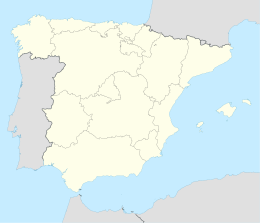
| Comunità autonoma | |||
| Provincia | |||
| Territorio | |||
| Coordinate | 40°15′56.16″N 4°28′05.88″W | ||
| Altitudine | 775 m s.l.m. | ||
| Superficie | 67,5 km² | ||
| Abitanti | 1 805 (2001) | ||
| Densità | 26,74 ab./km² | ||
| Comuni confinanti | Aldea en Cabo (TO), Almorox (TO), Cadalso de los Vidrios, Higuera de las Dueñas (AV), Nombela (TO), Paredes de Escalona (TO), Pelahustán (TO), Rozas de Puerto Real, Sotillo de la Adrada (AV) | ||
| Altre informazioni | |||
| Cod. postale | 28650 | ||
| Prefisso | (+34)... | ||
| Fuso orario | UTC+1 | ||
| Codice INE | 28037 | ||
| Targa | M | ||
| Cartografia | |||
 Cenicientos | |||
| Sito istituzionale | |||


Altri progetti
 Wikimedia Commons contiene immagini o altri file su Cenicientos
Collegamenti esterni
- Sito ufficiale, su cenicientos.es.
| Controllo di autorità | VIAF (EN) 246994987 |
|---|
На других языках
[en] Cenicientos
Cenicientos (Spanish pronunciation: [θeniˈθjentos]) is a municipality in the Community of Madrid, Spain. It is located in the southwesternmost end of the region. The municipality covers an area of 67.49 km2.[2] As of 2018[update], it has a population of 1,980. The urban settlement is located on the spurs of the Sistema Central, next to the Peña de Cenicientos (1,252 m), a small mountain range separated from the main range of the Sierra de Gredos and with continuity in the Sierra de San Vicente [es].[3][es] Cenicientos
Cenicientos es un municipio y localidad española de la Comunidad de Madrid, con una población de 1984 habitantes (INE 2017). Limítrofe con las provincias de Toledo y Ávila, se trata del municipio más occidental de la comunidad autónoma.[fr] Cenicientos
Cenicientos est une ville d’Espagne, dans la province de Madrid.- [it] Cenicientos
[ru] Сенисьентос
Сенисьентос (исп. Cenicientos) — муниципалитет в Испании, входит в провинцию Мадрид в составе автономного сообщества Мадрид. Муниципалитет находится в составе района (комарки) Сьерра-Оэсте-де-Мадрид. Занимает площадь 67,5 км². Население — 2102 человека (на 2010 год). Расстояние до административного центра провинции — 80 км.Текст в блоке "Читать" взят с сайта "Википедия" и доступен по лицензии Creative Commons Attribution-ShareAlike; в отдельных случаях могут действовать дополнительные условия.
Другой контент может иметь иную лицензию. Перед использованием материалов сайта WikiSort.org внимательно изучите правила лицензирования конкретных элементов наполнения сайта.
Другой контент может иметь иную лицензию. Перед использованием материалов сайта WikiSort.org внимательно изучите правила лицензирования конкретных элементов наполнения сайта.
2019-2026
WikiSort.org - проект по пересортировке и дополнению контента Википедии
WikiSort.org - проект по пересортировке и дополнению контента Википедии