world.wikisort.org - Spagna
Bohonal de Ibor è un comune spagnolo di 556 abitanti situato nella comunità autonoma dell'Estremadura.
|
Questa voce o sezione sull'argomento centri abitati della Spagna non cita le fonti necessarie o quelle presenti sono insufficienti.
|
| Bohonal de Ibor comune | |||
|---|---|---|---|
| |||
 | |||
| Localizzazione | |||
| Stato | |||
| Comunità autonoma | |||
| Provincia | |||
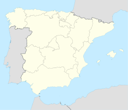
| Territorio | |||
| Coordinate | 39°47′03.84″N 5°29′03.12″W | ||
| Altitudine | 358 m s.l.m. | ||
| Superficie | 64,60 km² | ||
| Abitanti | 556 (2001) | ||
| Densità | 8,61 ab./km² | ||
| Comuni confinanti | Berrocalejo, Castañar de Ibor, El Gordo, Mesas de Ibor, Peraleda de la Mata, Peraleda de San Román, Valdehúncar | ||
| Altre informazioni | |||
| Cod. postale | 10320 | ||
| Prefisso | (+34)... | ||
| Fuso orario | UTC+1 | ||
| Codice INE | 10030 | ||
| Targa | CC | ||
| Cartografia | |||
 Bohonal de Ibor | |||
| Sito istituzionale | |||

Altri progetti
 Wikimedia Commons contiene immagini o altri file su Bohonal de Ibor
Collegamenti esterni
- Sito ufficiale, su bohonaldeibor.es.
| Controllo di autorità | VIAF (EN) 316734466 |
|---|
На других языках
[de] Bohonal de Ibor
Bohonal de Ibor ist ein Ort und eine Gemeinde (municipio) mit 500 Einwohnern (Stand 1. Januar 2019) in der Provinz Cáceres in der Autonomen Region Extremadura im Südwesten Spaniens.[en] Bohonal de Ibor
Bohonal de Ibor (pronounced [bo(o)ˈnal de iˈβoɾ]) is a municipality located in the province of Cáceres, Extremadura, Spain. According to the 2006 census (INE), the municipality has a population of 542 inhabitants.[es] Bohonal de Ibor
Bohonal de Ibor es un municipio y localidad española de la provincia de Cáceres, en la comunidad autónoma de Extremadura. Se sitúa entre el río Tajo (norte) con buena parte de su término sumergido bajo el embalse de Valdecañas, el río Gualija (este) y el río Ibor (oeste). Es uno de los cinco pueblos que tras la creación de las comunidades autónomas pasaron a denominarse en conjunto Los Ibores. Forma parte de la mancomunidad del Campo Arañuelo.[fr] Bohonal de Ibor
Bohonal de Ibor est une commune de la province de Cáceres dans la communauté autonome d'Estrémadure en Espagne.- [it] Bohonal de Ibor
[ru] Боональ-де-Ибор
Боональ-де-Ибор (исп. Bohonal de Ibor) — муниципалитет в Испании, входит в провинцию Касерес в составе автономного сообщества Эстремадура. Муниципалитет находится в составе района (комарки) Лос-Иборес. Занимает площадь 64,6 км². Население — 558 человек (на 2010 год).Текст в блоке "Читать" взят с сайта "Википедия" и доступен по лицензии Creative Commons Attribution-ShareAlike; в отдельных случаях могут действовать дополнительные условия.
Другой контент может иметь иную лицензию. Перед использованием материалов сайта WikiSort.org внимательно изучите правила лицензирования конкретных элементов наполнения сайта.
Другой контент может иметь иную лицензию. Перед использованием материалов сайта WikiSort.org внимательно изучите правила лицензирования конкретных элементов наполнения сайта.
2019-2026
WikiSort.org - проект по пересортировке и дополнению контента Википедии
WikiSort.org - проект по пересортировке и дополнению контента Википедии