world.wikisort.org - Spagna
Arandilla è un comune spagnolo di 162 abitanti situato nella comunità autonoma di Castiglia e León.
| Arandilla comune | |||
|---|---|---|---|
| |||
 | |||
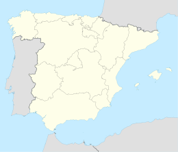
| Localizzazione | |||
| Stato | |||
| Comunità autonoma | |||
| Provincia | |||
| Territorio | |||
| Coordinate | 41°44′15″N 3°25′43″W | ||
| Altitudine | 887 m s.l.m. | ||
| Superficie | 26,68 km² | ||
| Abitanti | 162[1] (1-1-2020) | ||
| Densità | 6,07 ab./km² | ||
| Altre informazioni | |||
| Cod. postale | 09410 | ||
| Prefisso | (+34) 947 | ||
| Fuso orario | UTC+1 | ||
| Codice INE | 09019 | ||
| Targa | BU | ||
| Cartografia | |||
 Arandilla | |||
| Sito istituzionale | |||


Il comune comprende le località di Arandilla (capoluogo) e Valverde.
Note
- (ES) Cifras oficiales de población resultantes de la revisión del Padrón municipal a 1 de enero, su ine.es. URL consultato il 25 marzo 2021.
Altri progetti
 Wikimedia Commons contiene immagini o altri file su Arandilla
Collegamenti esterni
- Sito ufficiale, su arandilla.es.
На других языках
[de] Arandilla (Burgos)
Arandilla ist ein nordspanischer Ort und eine Gemeinde (municipio) mit nur noch 160 Einwohnern (Stand 1. Januar 2019) im Süden der spanischen Provinz Burgos in der autonomen Region Kastilien-León. Der Ort gehört zur bevölkerungsarmen Region der Serranía Celtibérica.[en] Arandilla
Arandilla is a municipality and town located in the province of Burgos, Castile and León, Spain. According to the 2004 census (INE), the municipality has a population of 191 inhabitants.[es] Arandilla (Burgos)
Arandilla es una localidad y un municipio[1] situados en la provincia de Burgos, comunidad autónoma de Castilla y León (España), comarca de La Ribera, partido judicial de Aranda, ayuntamiento del mismo nombre.[fr] Arandilla
Arandilla est une commune d'Espagne dans la communauté autonome de Castille-et-León, province de Burgos. Elle s'étend sur 26,68 km2 et comptait environ 180 habitants en 2011.- [it] Arandilla
[ru] Арандилья
Арандилья (исп. Arandilla) — муниципалитет в Испании, входит в провинцию Бургос, в составе автономного сообщества Кастилия и Леон. Муниципалитет находится в составе района (комарки) Рибера-дель-Дуэро. Занимает площадь 27 км². Население — 184 человека (на 2010 год). Расстояние до административного центра провинции — 104 км.Текст в блоке "Читать" взят с сайта "Википедия" и доступен по лицензии Creative Commons Attribution-ShareAlike; в отдельных случаях могут действовать дополнительные условия.
Другой контент может иметь иную лицензию. Перед использованием материалов сайта WikiSort.org внимательно изучите правила лицензирования конкретных элементов наполнения сайта.
Другой контент может иметь иную лицензию. Перед использованием материалов сайта WikiSort.org внимательно изучите правила лицензирования конкретных элементов наполнения сайта.
2019-2026
WikiSort.org - проект по пересортировке и дополнению контента Википедии
WikiSort.org - проект по пересортировке и дополнению контента Википедии