world.wikisort.org - Espagne
Villayón est une commune (concejo aux Asturies) située dans la communauté autonome des Asturies en Espagne.
Cet article est une ébauche concernant une localité des Asturies.
Vous pouvez partager vos connaissances en l’améliorant (comment ?) selon les recommandations des projets correspondants.
Consultez la liste des tâches à accomplir en page de discussion.
| Villayón | ||||
 Héraldique |
||||
| Administration | ||||
|---|---|---|---|---|
| Pays | ||||
| Communauté autonome | ||||
| Code postal | 33717 | |||
| Démographie | ||||
| Population | 1 151 hab. () | |||
| Densité | 8,7 hab./km2 | |||
| Géographie | ||||
| Coordonnées | 43° 24′ 32″ nord, 6° 42′ 25″ ouest | |||
| Altitude | 357 m |
|||
| Superficie | 13 246 ha = 132,46 km2 | |||
| Localisation | ||||
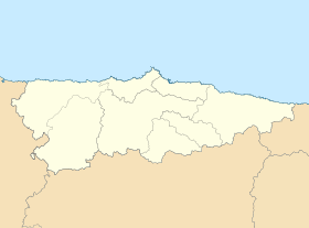
| Géolocalisation sur la carte : Espagne
Géolocalisation sur la carte : Espagne
Géolocalisation sur la carte : Asturies
| ||||
| Liens | ||||
| Site web | www.villayon.es | |||
| modifier |
||||


Sites et monuments
Il y a 3 Cascades impressionnantes
Notes et références
Voir aussi
Article connexe
- Liste des communes des Asturies
Lien externe
 Portail des Asturies
На других языках
[de] Villayón
Villayón ist eine Stadt und auch Namensgeberin der gleichnamigen Gemeinde in der autonomen Gemeinschaft Asturien, im Norden Spaniens.[en] Villayón
Villayón (Spanish pronunciation: [bi.ʎa.ˈʝon]) is a municipality in the Autonomous Community of the Principality of Asturias, Spain. It is bordered on the north by Navia, on the west by Coaña, Boal and Illano, on the east by Valdés, Tineo y Allande and on the south by Allande.[es] Villayón
Villayón es un concejo de la comunidad autónoma del Principado de Asturias (España), localizado en la comarca occidental de la región dentro de la cuenca del río Navia. Asimismo es una parroquia de dicho concejo y una villa de dicha parroquia, capital del concejo homónimo.- [fr] Villayón
[ru] Вильяйон
Вильяйон (исп. Villayón, баск. Villayon) — населённый пункт и муниципалитет в Испании, входит в провинцию Астурия. Муниципалитет находится в составе района (комарки) Эо-Навия. Занимает площадь 132,46 км². Население — 1721 человек.Текст в блоке "Читать" взят с сайта "Википедия" и доступен по лицензии Creative Commons Attribution-ShareAlike; в отдельных случаях могут действовать дополнительные условия.
Другой контент может иметь иную лицензию. Перед использованием материалов сайта WikiSort.org внимательно изучите правила лицензирования конкретных элементов наполнения сайта.
Другой контент может иметь иную лицензию. Перед использованием материалов сайта WikiSort.org внимательно изучите правила лицензирования конкретных элементов наполнения сайта.
2019-2026
WikiSort.org - проект по пересортировке и дополнению контента Википедии
WikiSort.org - проект по пересортировке и дополнению контента Википедии