world.wikisort.org - Espagne
Villalbilla de Gumiel est une commune d’Espagne, dans la province de Burgos, communauté autonome de Castille-et-León. Cette localité est également vinicole, et fait partie de l’AOC Ribera del Duero.
| Villalbilla de Gumiel | |||
 Héraldique |
|||
| Administration | |||
|---|---|---|---|
| Pays | |||
| Communauté autonome | Castille-et-León | ||
| Province | Burgos | ||
| Comarque | Ribera del Duero | ||
| Code postal | 09453 | ||
| Démographie | |||
| Gentilé | Garruchos/as | ||
| Population | 86 hab. () | ||
| Densité | 3,3 hab./km2 | ||
| Géographie | |||
| Coordonnées | 41° 48′ 24″ nord, 3° 37′ 34″ ouest | ||
| Altitude | 916 m |
||
| Superficie | 2 641 ha = 26,41 km2 | ||
| Localisation | |||
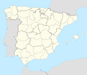
| Géolocalisation sur la carte : Espagne
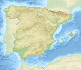
Géolocalisation sur la carte : Espagne
| |||
| Liens | |||
| Site web | http://www.villalbilladegumiel.com/ | ||
| modifier |
|||
Voir aussi
- Liste des communes de Burgos
- AOC Ribera del Duero
- Province de Burgos
Source
- (es) Cet article est partiellement ou en totalité issu de l’article de Wikipédia en espagnol intitulé « Villalbilla de Gumiel » (voir la liste des auteurs).
- Portail de Castille-et-León
На других языках
[de] Villalbilla de Gumiel
Villalbilla de Gumiel ist eine Gemeinde (municipio) mit 81 Einwohnern (Stand: 1. Januar 2019) im Zentrum der Provinz Burgos in der Autonomen Gemeinschaft Kastilien und León. Villalbilla de Gumiel liegt in der Comarca und der Weinbauregion Ribera del Duero.[en] Villalbilla de Gumiel
Villalbilla de Gumiel is a municipality located in the province of Burgos, Castile and León, Spain. According to the 2001 census (INE), the municipality has a population of 127 inhabitants.[es] Villalbilla de Gumiel
Villalbilla de Gumiel es una localidad y un municipio[1] situados en la provincia de Burgos, comunidad autónoma de Castilla y León (España), comarca de La Ribera, partido judicial de Aranda, ayuntamiento del mismo nombre.- [fr] Villalbilla de Gumiel
[ru] Вильяльбилья-де-Гумьель
Вильяльбилья-де-Гумьель (исп. Villalbilla de Gumiel) — муниципалитет в Испании, входит в провинцию Бургос, в составе автономного сообщества Кастилия и Леон. Муниципалитет находится в составе района (комарки) Рибера-дель-Дуэро. Занимает площадь 26 км². Население — 105 человек (на 2010 год). Расстояние до административного центра провинции — 18 км.Текст в блоке "Читать" взят с сайта "Википедия" и доступен по лицензии Creative Commons Attribution-ShareAlike; в отдельных случаях могут действовать дополнительные условия.
Другой контент может иметь иную лицензию. Перед использованием материалов сайта WikiSort.org внимательно изучите правила лицензирования конкретных элементов наполнения сайта.
Другой контент может иметь иную лицензию. Перед использованием материалов сайта WikiSort.org внимательно изучите правила лицензирования конкретных элементов наполнения сайта.
2019-2025
WikiSort.org - проект по пересортировке и дополнению контента Википедии
WikiSort.org - проект по пересортировке и дополнению контента Википедии

