world.wikisort.org - Espagne
Teverga (Teberga en asturien) est une commune (concejo aux Asturies) située dans la communauté autonome des Asturies en Espagne.
Cet article est une ébauche concernant une localité des Asturies.
Vous pouvez partager vos connaissances en l’améliorant (comment ?) selon les recommandations des projets correspondants.
Consultez la liste des tâches à accomplir en page de discussion.
| Teverga Teberga (ast) | ||||
 Héraldique |
 Drapeau |
|||
| Administration | ||||
|---|---|---|---|---|
| Pays | ||||
| Communauté autonome | ||||
| Code postal | 33111 | |||
| Démographie | ||||
| Population | 1 584 hab. () | |||
| Densité | 9,4 hab./km2 | |||
| Géographie | ||||
| Coordonnées | 43° 08′ 42″ nord, 6° 07′ 13″ ouest | |||
| Superficie | 16 886 ha = 168,86 km2 | |||
| Localisation | ||||
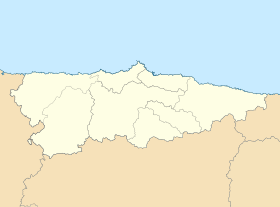
| Géolocalisation sur la carte : Espagne
Géolocalisation sur la carte : Espagne
Géolocalisation sur la carte : Asturies
| ||||
| Liens | ||||
| Site web | www.aytoteverga.org | |||
| modifier |
||||


Notes et références
Voir aussi
Article connexe
- Liste des communes des Asturies
Lien externe
 Portail des Asturies
На других языках
[de] Teverga
Teverga (asturisch Teberga) ist eine Gemeinde (concejo) in der Autonomen Region Asturien in Spanien. Der Hauptort und Sitz der Gemeindeverwaltung ist La Plaza.[en] Teverga
Teverga (Asturian: Teberga) is a municipality in the Autonomous Community of the Principality of Asturias, Spain. It is bordered on the north by Belmonte de Miranda, Grado, Yernes y Tameza, and Proaza; to the south by León province, to the west by Somiedo and to the east by Quirós and Proaza.[es] Teverga
Teverga (en asturiano, Teberga) es un concejo de la comunidad autónoma del Principado de Asturias. Limita al norte con Belmonte de Miranda, Grado, Yernes y Tameza, y Proaza; al sur con la provincia de León, al oeste con Somiedo y al este con Quirós y Proaza.- [fr] Teverga
[ru] Теверга
Теверга (исп. Teverga, астур. Teberga) — муниципалитет в Испании, входит в провинцию Астурия. Муниципалитет находится в составе района (комарки) Овьедо. Занимает площадь 168,86 км². Население — 1 973 человека.Текст в блоке "Читать" взят с сайта "Википедия" и доступен по лицензии Creative Commons Attribution-ShareAlike; в отдельных случаях могут действовать дополнительные условия.
Другой контент может иметь иную лицензию. Перед использованием материалов сайта WikiSort.org внимательно изучите правила лицензирования конкретных элементов наполнения сайта.
Другой контент может иметь иную лицензию. Перед использованием материалов сайта WikiSort.org внимательно изучите правила лицензирования конкретных элементов наполнения сайта.
2019-2026
WikiSort.org - проект по пересортировке и дополнению контента Википедии
WikiSort.org - проект по пересортировке и дополнению контента Википедии