world.wikisort.org - Espagne
Terzaga est une commune d'Espagne de la province de Guadalajara dans la communauté autonome de Castille-La Manche.
| Terzaga | ||||
| Administration | ||||
|---|---|---|---|---|
| Pays | ||||
| Communauté autonome | ||||
| Province | ||||
| Code postal | 19312 | |||
| Démographie | ||||
| Population | 20 hab. () | |||
| Densité | 0,59 hab./km2 | |||
| Géographie | ||||
| Coordonnées | 40° 41′ 40″ nord, 1° 54′ 16″ ouest | |||
| Altitude | 1 079 m |
|||
| Superficie | 3 381 ha = 33,81 km2 | |||
| Localisation | ||||
| Géolocalisation sur la carte : Castille-La Manche
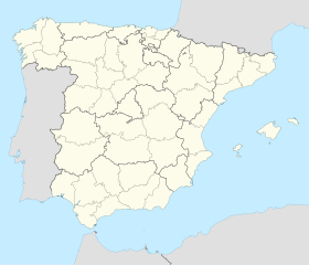
Géolocalisation sur la carte : Espagne
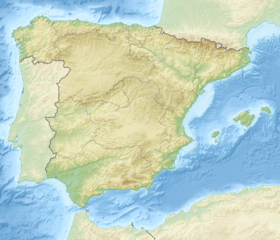
Géolocalisation sur la carte : Espagne
| ||||
| modifier |
||||
Géographie
Histoire
Administration
Culture
- Portail de Castille-La Manche
На других языках
[en] Terzaga
Terzaga is a municipality located in the province of Guadalajara, Castile-La Mancha, Spain. According to the 2017 census (INE), the municipality has a population of 23 inhabitants. It belongs to the Alto Tajo Natural Park and the Geopark of the Comarca Molina-Alto Tajo. It has an area of 33.81 km². From Guadalajara capital it is separated by a distance of 159 km. It is one of the localities through which the route of the Three Taifas of the Camino del Cid takes place.[es] Terzaga
Terzaga es un municipio y localidad española de la provincia de Guadalajara, en la comunidad autónoma de Castilla-La Mancha. Situado al sur de la comarca del Señorío de Molina, dentro de la Sexma de la Sierra a una altitud de unos 1179 metros, pertenece al parque natural del Alto Tajo y al Geoparque de la Comarca Molina-Alto Tajo. Tiene una superficie de 33,81 km² con una población de 22 habitantes (INE 2018). En su término se encuentra el caserío deshabitado y en ruinas de Terzaguilla. De Guadalajara capital le separa una distancia de 159 km, de Teruel 97 km, de Cuenca 109 km, y de Madrid 224 km. Es una de las localidades por las que transcurre la ruta de las Tres Taifas del Camino del Cid.- [fr] Terzaga
[ru] Терсага
Терсага (исп. Terzaga) — муниципалитет в Испании, входит в провинцию Гвадалахара, в составе автономного сообщества Кастилия-Ла-Манча. Муниципалитет находится в составе района (комарки) Сеньорио-де-Молина-Альто-Тахо. Население — 26 человек (на 2010 год).Текст в блоке "Читать" взят с сайта "Википедия" и доступен по лицензии Creative Commons Attribution-ShareAlike; в отдельных случаях могут действовать дополнительные условия.
Другой контент может иметь иную лицензию. Перед использованием материалов сайта WikiSort.org внимательно изучите правила лицензирования конкретных элементов наполнения сайта.
Другой контент может иметь иную лицензию. Перед использованием материалов сайта WikiSort.org внимательно изучите правила лицензирования конкретных элементов наполнения сайта.
2019-2025
WikiSort.org - проект по пересортировке и дополнению контента Википедии
WikiSort.org - проект по пересортировке и дополнению контента Википедии


