world.wikisort.org - Espagne
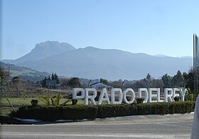
Prado del Rey est une ville d’Espagne, dans la province de Cadix, communauté autonome d’Andalousie.
Géographie
Histoire
Article connexe
- Route des Villages blancs
- Portail de l’Andalousie
На других языках
[de] Prado del Rey
Prado del Rey („Wiese des Königs“) ist eine Kleinstadt und eine südspanische Gemeinde (municipio) mit 5.605 Einwohnern (Stand 1. Januar 2019) im Nordosten der Provinz Cádiz in der Autonomen Region Andalusien. Prado del Rey liegt an der „Straße der weißen Dörfer“ (Ruta de los Pueblos Blancos).[es] Prado del Rey
Prado del Rey es un municipio y localidad española de la provincia de Cádiz, en la comunidad autónoma de Andalucía. Cuenta con una población de 5655 habitantes (INE 2021). Se encuentra situada a una altitud de 440 metros y a 105 kilómetros de la capital de provincia, Cádiz. Se ubica en la ruta de los pueblos blancos entre las poblaciones de Arcos de la Frontera y El Bosque.- [fr] Prado del Rey
[ru] Прадо-дель-Рей
Прадо-дель-Рей (исп. Prado del Rey) — населённый пункт и муниципалитет в Испании, входит в провинцию Кадис, в составе автономного сообщества Андалусия. Муниципалитет находится в составе района (комарки) Сьерра-де-Кадис. Занимает площадь 49 км². Население — 5948 человек (на 2010 год). Расстояние — 105 км до административного центра провинции.Текст в блоке "Читать" взят с сайта "Википедия" и доступен по лицензии Creative Commons Attribution-ShareAlike; в отдельных случаях могут действовать дополнительные условия.
Другой контент может иметь иную лицензию. Перед использованием материалов сайта WikiSort.org внимательно изучите правила лицензирования конкретных элементов наполнения сайта.
Другой контент может иметь иную лицензию. Перед использованием материалов сайта WikiSort.org внимательно изучите правила лицензирования конкретных элементов наполнения сайта.
2019-2025
WikiSort.org - проект по пересортировке и дополнению контента Википедии
WikiSort.org - проект по пересортировке и дополнению контента Википедии


